Driving up a mountain
On my recent road trip to Alberta, I stopped for the night in Sicamous. There’s a forest service road that starts right in town and goes up to the top of nearby Mount Quest. It’s an easy way to get a nice view, so I thought I’d mention it – stop by if you can. Not recommended for low-riding cars though; there are some spots with deep ruts.

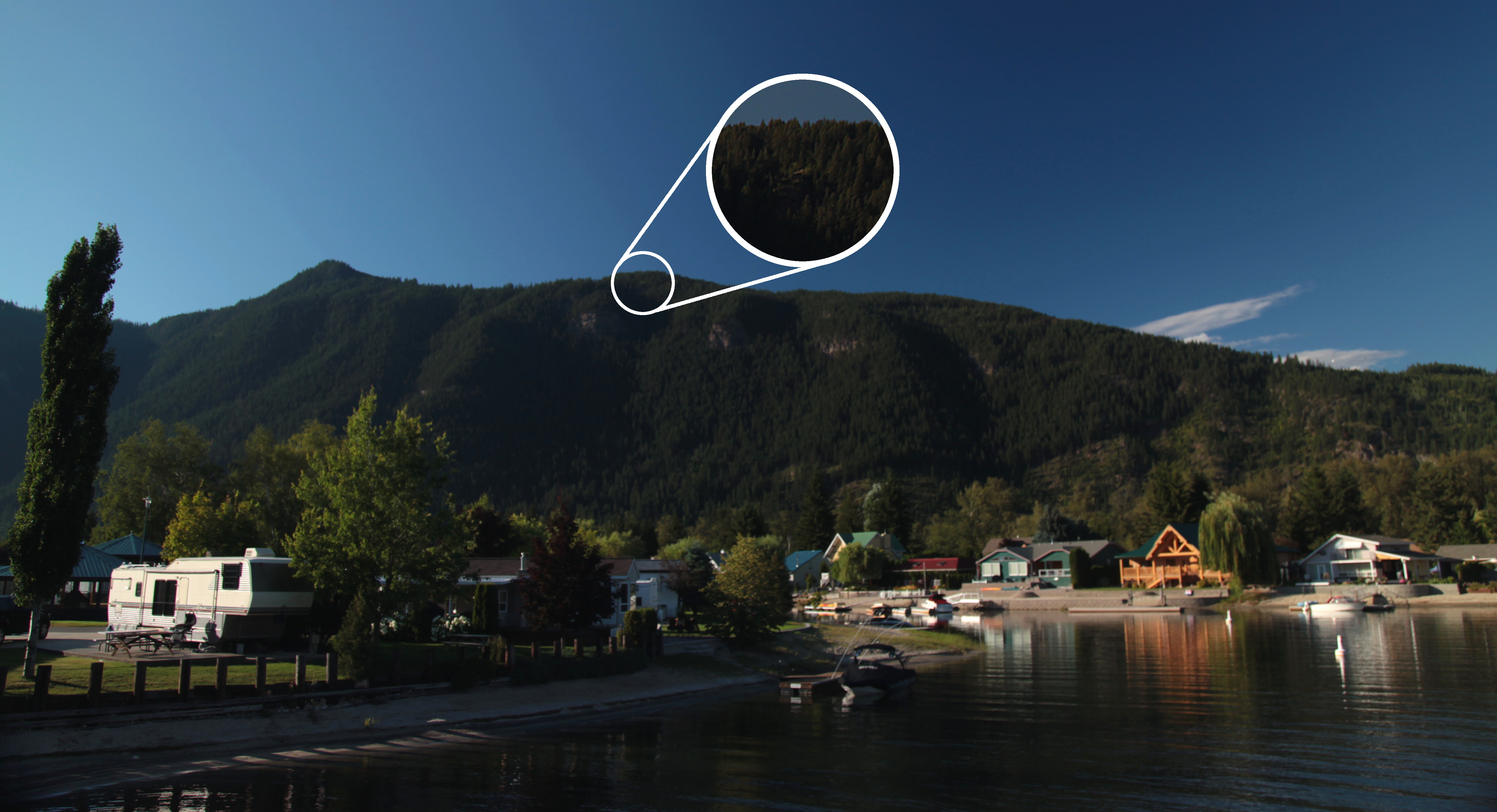
Here’s the view from the top, stitched with the software that came with my new camera since AutoStitch can’t handle large images. That’s the town of Sicamous on the left. The wood in the foreground is of unknown purpose, but I gather hang-gliders use it as a lanuching point.
Here’s where I took the picture from, as seen from the town:
On the way down, I noticed some land for sale signs down the other branches of the logging road. It’s a flat-topped mountain, so it makes sense they could develop up there, but it makes me sad to think of the mountains getting encrusted with the same butt-ugly cookie-cutter housing developments that most cities and large towns are getting these days.
Here’s the GPS log of this side trip, so you can find the road: Mount_Quest
[gmap file=’http://www.soleillapierre.ca/blog/wp-content/uploads/2010/08/Mount_Quest.kmz’ width=’80%’]
Long Beach vacation day 6
Thursday October 15, 2009.
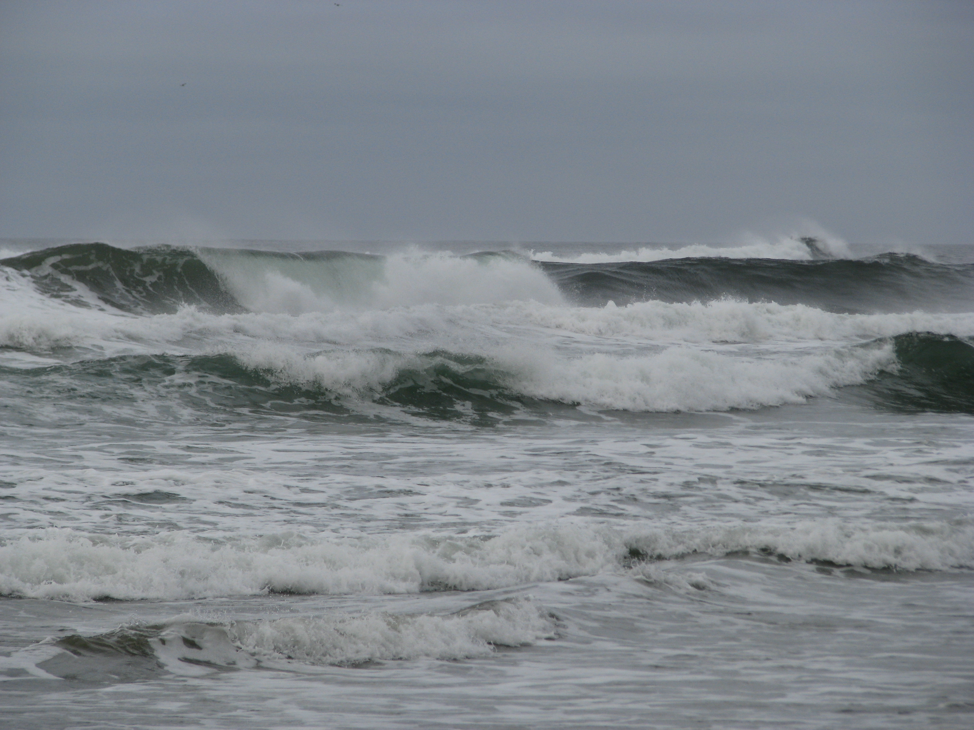 Today being my last full day here, I really wanted to get to the bottom of the Schooner Cove mystery and see where my parents hung out before I was born. After discussing what I saw yesterday with my mother on the phone, I concluded that there was much more to Schooner Cove than what is immediately visible from the end of the boardwalk; the real cove is around the corner from there, and you have to climb over rocks at not-high-tide to reach it. I consulted the tide chart and determined that I had a few hours to kill before it would be accessible, so I went down to walk the length of Wickaninnish Beach.
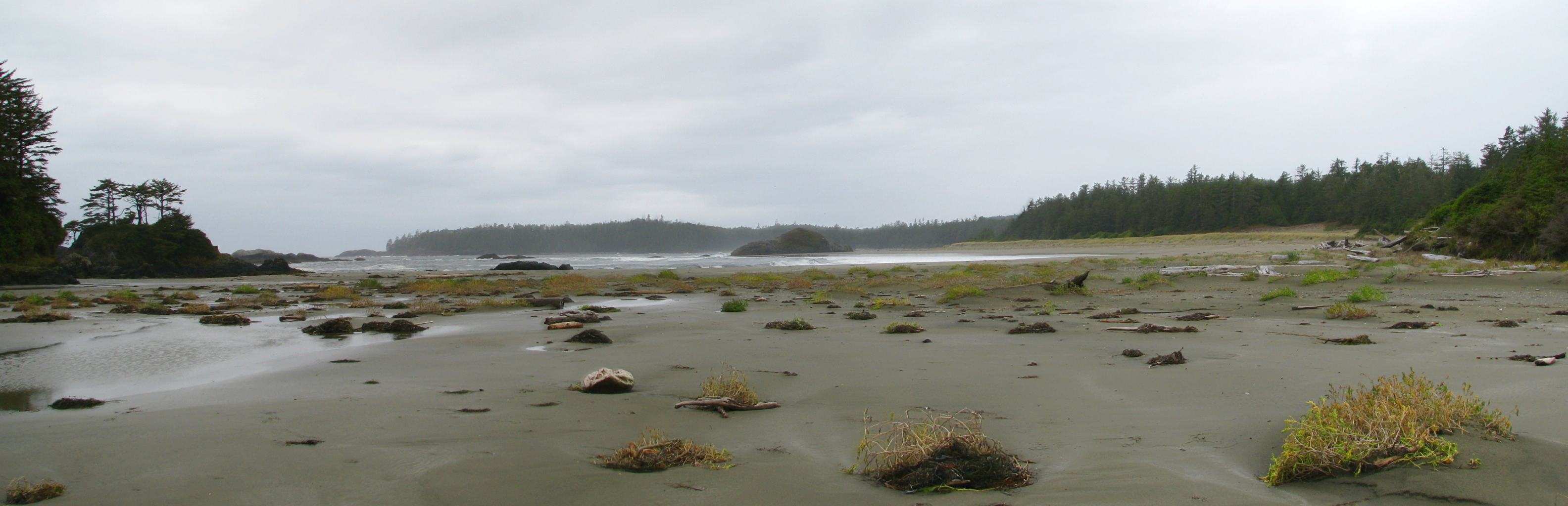
Not much to say about this beach. I ended up not going the whole length because I spotted some fresh what-a-bear-does-on-the-beach on the way, and given that the high tide forced me to walk near the woods that kind of made me nervous. Bears and cougars and me don’t get on so well. It turns out there have only been five cougar-related fatalities in the last hundred years in B.C., but four of those occurred on the island and they didn’t say anything about non-fatal maulings. So I cut that walk short, and instead spent some time at the Shore Pine Bog Trail. This is one thing I do remember from my childhood visit; the bizarrely twisted trees and relatively open, meadowy spaces really made an impression on me, as did the presence of carnivorous plants (honeydew; though I didn’t spot them this time). It’s still as starkly gorgeous as I remember:
![]()
Then I headed for Schooner Cove again. This time I avoided the long and hilly boardwalk by parking at Incinerator Rock and walking across the beach to get there. Even a couple of hours after the tide started going out it was still a little tricky to reach the proper cove without getting wet, but I was rewarded with a view that dislodged some more memories:
I remember when I was here as a kid, my mother took me to one of the rock outcrops along a beach and showed me the spot where my father crashed his Morris Minor. He had hit the rock and got stuck in the sand, and the tide was coming in – he had no choice but to abandon the car and watch the water rip it to pieces. I remember there still being a rusted engine block at the foot of the outcrop, but that might be a false memory – it may be that my parents told me it was still there a couple of years later, not that it was still there when I myself was present. Must ask about that. Anyway, I mentioned in an earlier post that I thought the rock outcrop in question was the one I first saw on arrival a couple of days ago, but the one in the middle of the above picture much more closely matches the shape of what I remember from my childhood visit. On the third hand, when walking back through the tidal choke point from here to where I parked, I almost tripped over a rusted metal contraption of some kind sticking out of the sand. I’d like to think it was from the same car, but more likely it’s a much more recent thing; oxidizable metals just don’t last 30+ years in this environment.
Anyway, I’m pretty sure that somewhere visible in the above photo, or not far away from it, is the location of the tree house my parents built and lived in while they were here. No doubt the house and those of the neighbors are long gone since this is now park land, but I would very much like to return some time and locate it more precisely. I almost reached my ancestral spawning grounds, but not quite.
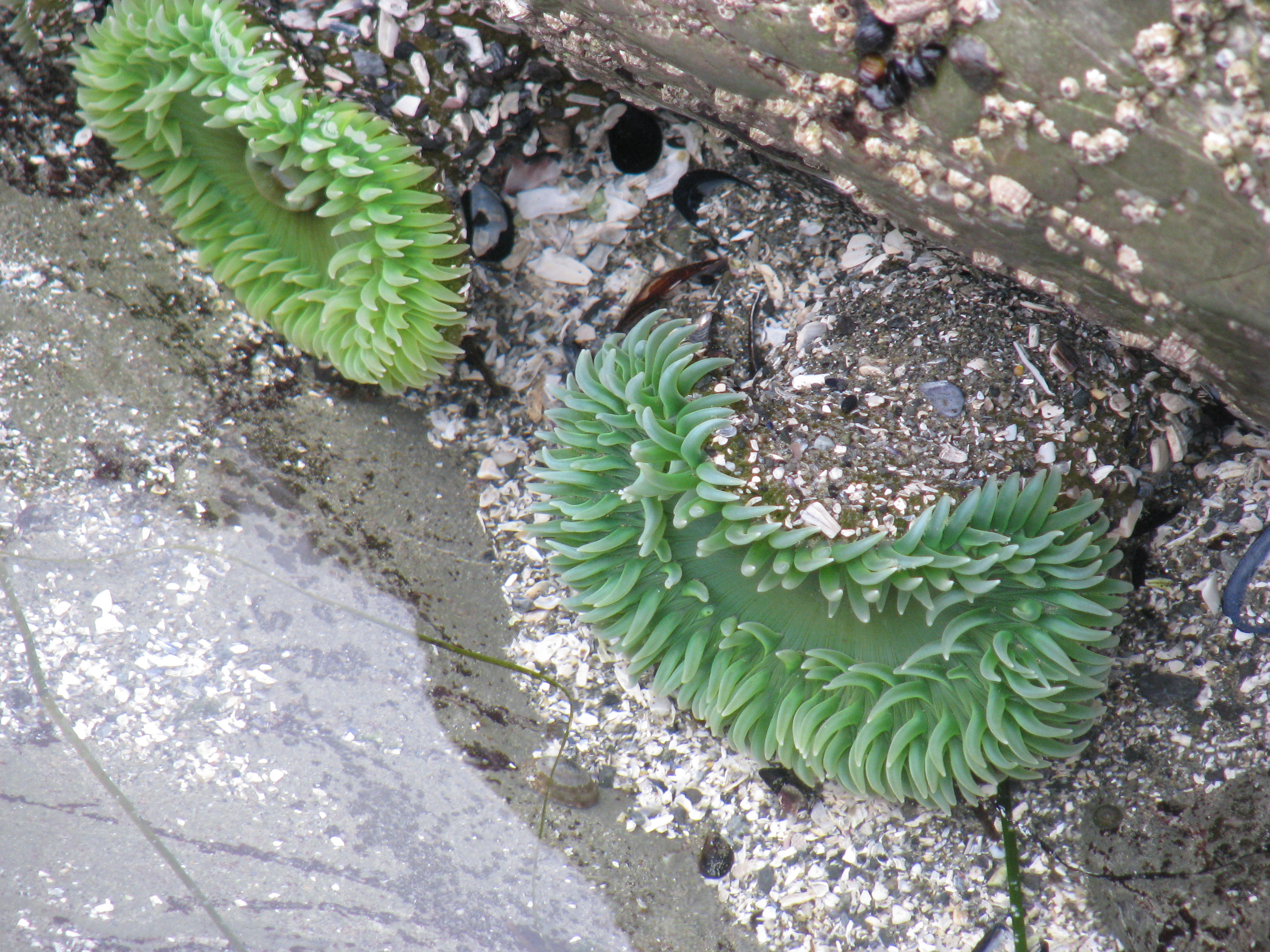 By this point I was feeling a bit nervous about wildlife since there was nobody else in sight and no other footprints in the sand, and also I wasn’t sure how long I had before the tide started coming back in again and I didn’t want to risk getting cut off. So I went back to the not-choke-point area and spent some time poking at life forms in the tidal pools.
There was nothing else I wanted to do that I thought I could pack into the day, so I went back to Tofino for supper. Ate at a local spot called The Schooner. I was a bit put off by their prices and that none of their plethora of menus is all-day, but it was OK food anyway. I noticed they had an extensive breakfast menu so I planned to eat there tomorrow before heading home.
Returned to the resort and took a post-sunset walk on the beach to say goodbye, and called it a night.
End of the third and last full day at the beach. Today’s GPS track:
[gmap type=”satellite” width=”80%” zoom=”auto” center=”files” file=’__UPLOAD__/2009/10/20091015.kmz’]
Offroad adventure
I wanted to relate a rather exciting bit of travel I did a couple of weeks back; it was what finally gelled the idea of getting this blog going as a place to travel-blog, since I have two travel adventures being planned right now (Long Beach next week, and cross-Canada in 2011).
How this all got started was that last year, I went to the Granville Island Market and there looked at the wares of a local photographer who was selling her photos as cards and framed prints. One of her photos was a picture of some dead tree stumps projecting from and reflecting in the still water of a mountain lake. I really liked it and asked her the location. Turns out it was taken at Stave Lake, which is the reservoir of a hydroelectric dam just northeast of Mission, B.C. If you look at the lake on Google Earth you can even see the many acres of drowned trees.
Then more recently my co-worker Ted mentioned having taken his kids on a tour of the old power station at Stave Lake. Having recently developed an interest in local industrial history, I decided to combine these two temptations into an excuse to finally go check the location out. I went to the power station (photos here) and then took a dirt road up the west side of the lake. That turned out to be a disappointment because it wasn’t very scenic and was full of offroaders. Looking more closely at the Globe of Google when I got home, it looked like I should be able to get down to the eastern shore via some logging roads on the other side of the lake. So I resolved to go back later.
Went back on the weekend of September 19th. First, let’s exercise WordPress’s Google Maps plugin with my GPS track (also downloadable here):
[gmap file=’http://www.soleillapierre.ca/blog/wp-content/uploads/2009/10/GPS_20090919.kmz’]
I omitted the long road between here and home for brevity.
I ended up not finding a road that led to the water. Turns out I got pretty close before the paths I chose petered out, but the undergrowth looked pretty thick and I didn’t want to go traipsing through possibly bear- and hunter-infested woods. Further up the hill there were lots of people practicing target-shooting by the side of the road. Looking at the GPS track later, I was a lot closer to the water than I thought. I intend to go back and try again sometime.
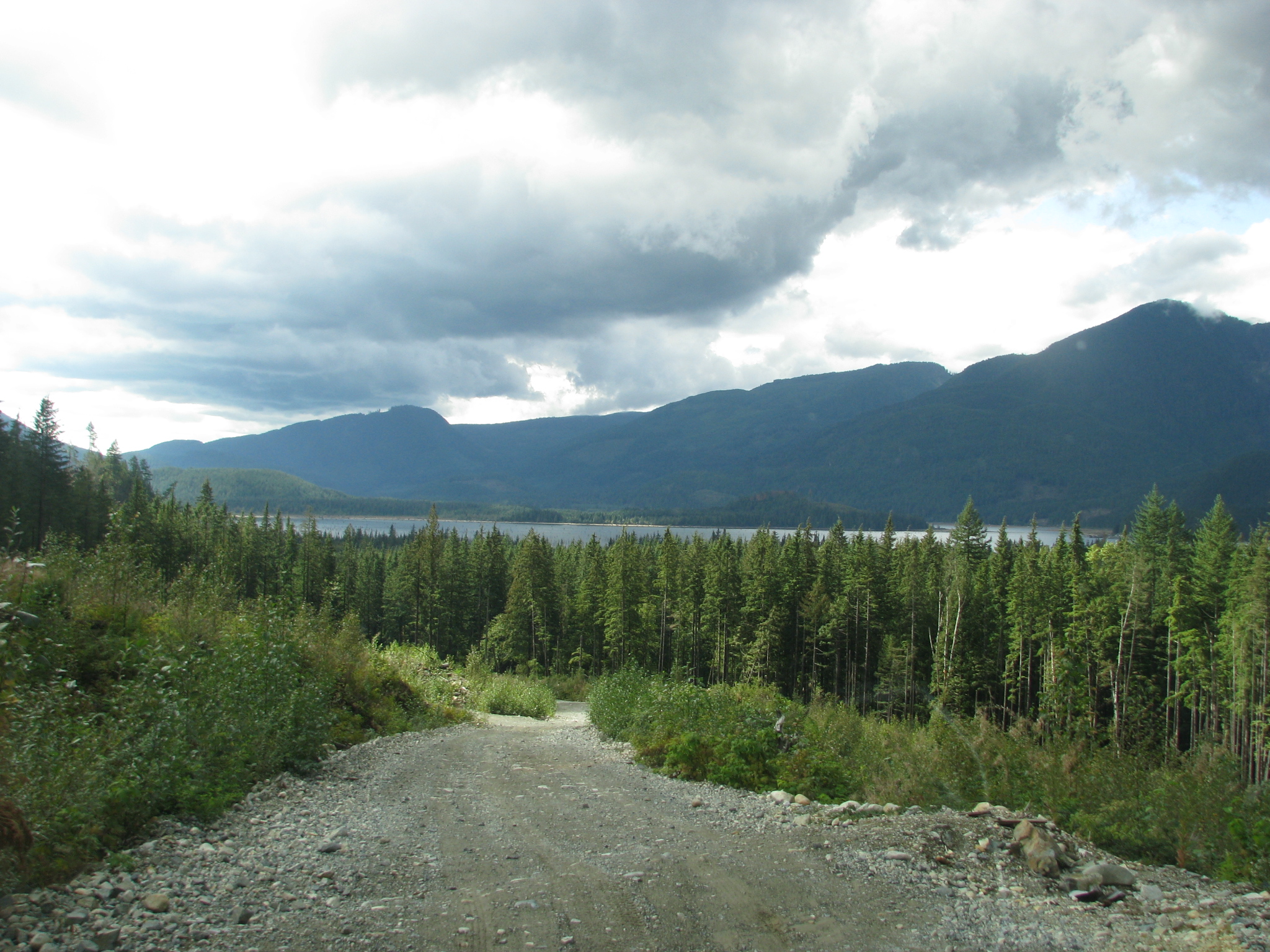
Here’s what the roads looked like at their best. Not too bad, but not passable by the average car – you can’t tell from this photo, but at regular intervals there were some very big speed bump / drainage channel things that would bottom out most cars.
Note the lack of trees near the road. From the Google Maps view above, you’d think this road went through dense forest. I discovered this to be shock when I got home and re-examined the area; the default view in Google Earth is actually the oldest image they have of the area. If you bring up the history slider and move it back just one notch, you’ll see the true state of the deforestation in the area. It was disappointing to realize this, and also annoying since I was making plans based on information that turned out to be wrong; the actual passability of the roads in this area is radically different from what the default GE view shows.
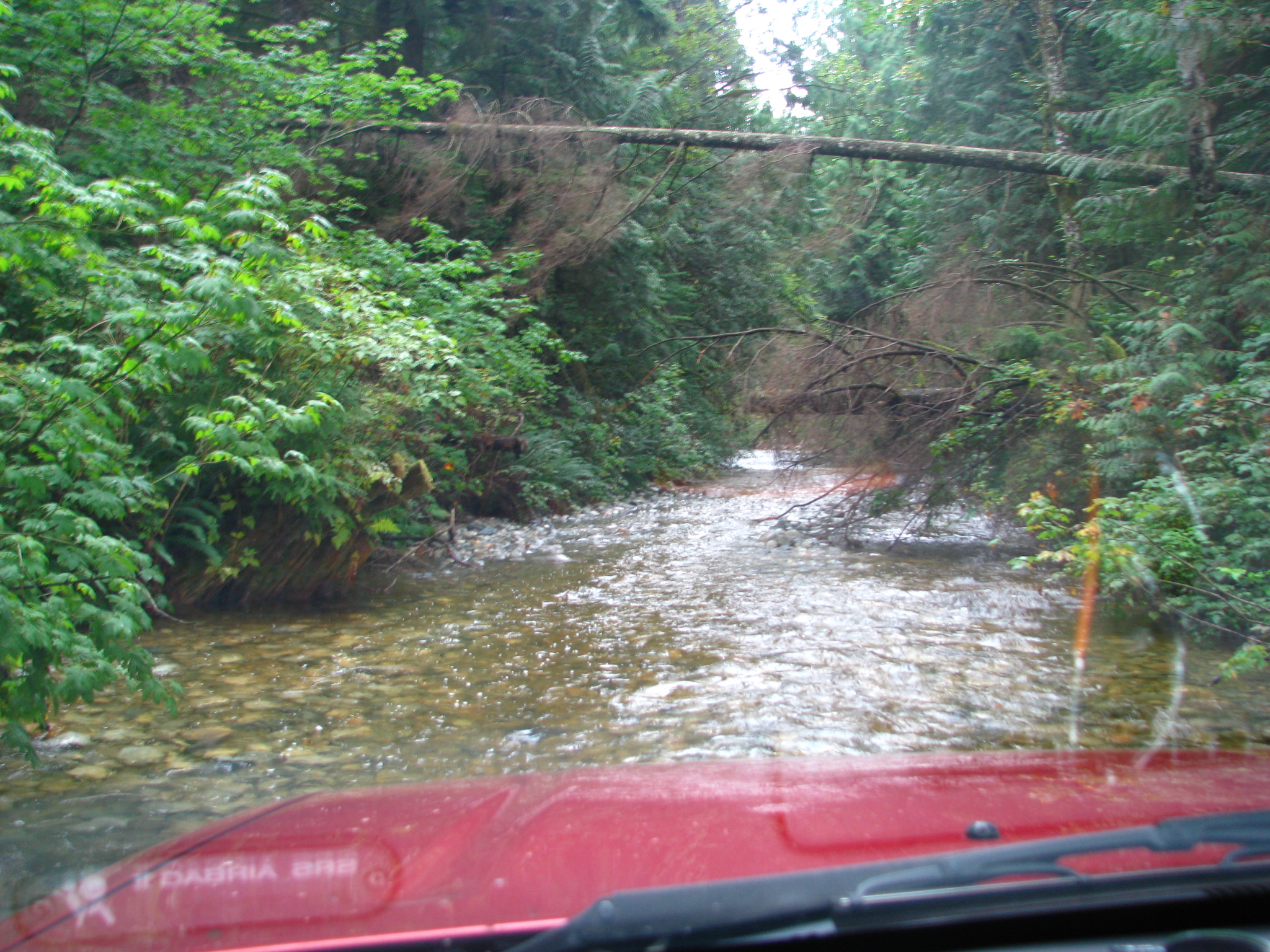
I actually ended up driving in a stream for about 200 feet. One of the trails I followed in trying to get to the shore led right into a stream, and then back out. Unfortunately it became impassable for me right after that, so I had to turn around.
Along one of these roads I spotted a rusted-out car wreck in the woods:
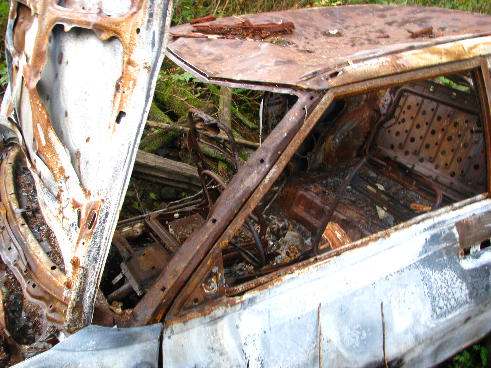
It’s easy to sneer at someone for taking a small car on these trails, but really I was being a bit foolish too – although my vehicle can be made into a semi-decent offroader, it’s currently tricked out for city and highway driving; my tires especially are not suitable for these muddy, rocky and sometimes water-covered roads. I could easily have got stuck too.
Having failed in several attempts to reach the shore, I decided to go up instead. I wanted to see if I could get high enough up the logging roads to get a good vista of the Fraser Valley.
Unfortunately the roads leading up turned out to be less passable than they appear on the (outdated) GE view. For one thing, there were some wooden bridges with low weight limit warnings on them – I had to search around to find out what my GVW was in order to determine if it was safe (it was) before crossing. Two of the three branches that appeared promising on GE were now impassable due to overgrowth or roadblocks, and the third – after some massive bumps that I scraped bottom on – led to this:

Looks more like a small landslide than a deliberate roadblock. Either way, while I have four-wheel drive I don’t have enough of it to get past that. And I couldn’t back out because those aforementioned big bumps would have taken my muffler off. So I had to turn around in place.
Except that in the muddy area earlier I had put on big rubber boots to test the depth of some of the puddles. When I was halfway turned around I accidentally pressed the gas pedal at the same time as the brake and very nearly drove off the edge. That gave me quite a fright.
Overall it was pretty fun though – it was a new experience to go crawling around rocky and muddly mountain trails in 4L gear, barely making 5 km/h and not wanting to go faster because it was so bumpy. Some nice scenery.
Never did get exactly the pictures I wanted, but I intend to go back some day. Now that I discovered the Google Earth Conspiracy, I can see more accurate views of the area and I think I’ve spotted a trail that does go down to the shore.