Long Beach vacation day 6
Thursday October 15, 2009.
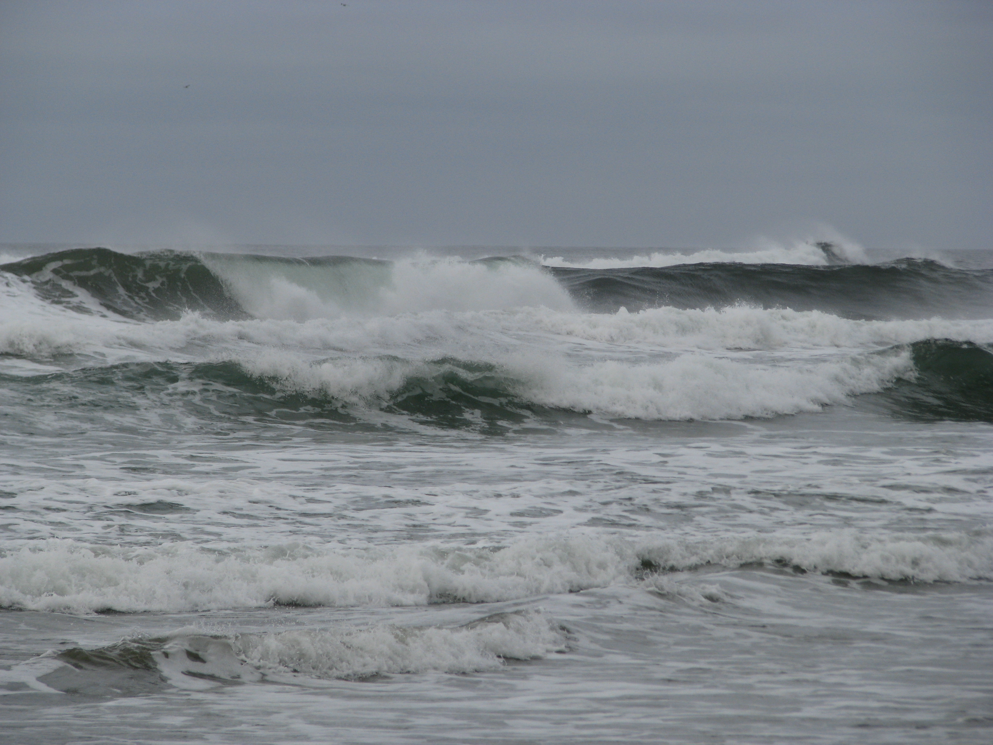 Today being my last full day here, I really wanted to get to the bottom of the Schooner Cove mystery and see where my parents hung out before I was born. After discussing what I saw yesterday with my mother on the phone, I concluded that there was much more to Schooner Cove than what is immediately visible from the end of the boardwalk; the real cove is around the corner from there, and you have to climb over rocks at not-high-tide to reach it. I consulted the tide chart and determined that I had a few hours to kill before it would be accessible, so I went down to walk the length of Wickaninnish Beach.
Not much to say about this beach. I ended up not going the whole length because I spotted some fresh what-a-bear-does-on-the-beach on the way, and given that the high tide forced me to walk near the woods that kind of made me nervous. Bears and cougars and me don’t get on so well. It turns out there have only been five cougar-related fatalities in the last hundred years in B.C., but four of those occurred on the island and they didn’t say anything about non-fatal maulings. So I cut that walk short, and instead spent some time at the Shore Pine Bog Trail. This is one thing I do remember from my childhood visit; the bizarrely twisted trees and relatively open, meadowy spaces really made an impression on me, as did the presence of carnivorous plants (honeydew; though I didn’t spot them this time). It’s still as starkly gorgeous as I remember:
![]()
Then I headed for Schooner Cove again. This time I avoided the long and hilly boardwalk by parking at Incinerator Rock and walking across the beach to get there. Even a couple of hours after the tide started going out it was still a little tricky to reach the proper cove without getting wet, but I was rewarded with a view that dislodged some more memories:
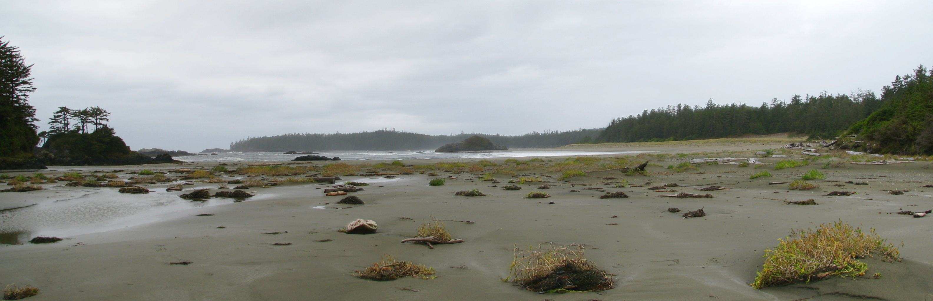
I remember when I was here as a kid, my mother took me to one of the rock outcrops along a beach and showed me the spot where my father crashed his Morris Minor. He had hit the rock and got stuck in the sand, and the tide was coming in – he had no choice but to abandon the car and watch the water rip it to pieces. I remember there still being a rusted engine block at the foot of the outcrop, but that might be a false memory – it may be that my parents told me it was still there a couple of years later, not that it was still there when I myself was present. Must ask about that. Anyway, I mentioned in an earlier post that I thought the rock outcrop in question was the one I first saw on arrival a couple of days ago, but the one in the middle of the above picture much more closely matches the shape of what I remember from my childhood visit. On the third hand, when walking back through the tidal choke point from here to where I parked, I almost tripped over a rusted metal contraption of some kind sticking out of the sand. I’d like to think it was from the same car, but more likely it’s a much more recent thing; oxidizable metals just don’t last 30+ years in this environment.
Anyway, I’m pretty sure that somewhere visible in the above photo, or not far away from it, is the location of the tree house my parents built and lived in while they were here. No doubt the house and those of the neighbors are long gone since this is now park land, but I would very much like to return some time and locate it more precisely. I almost reached my ancestral spawning grounds, but not quite.
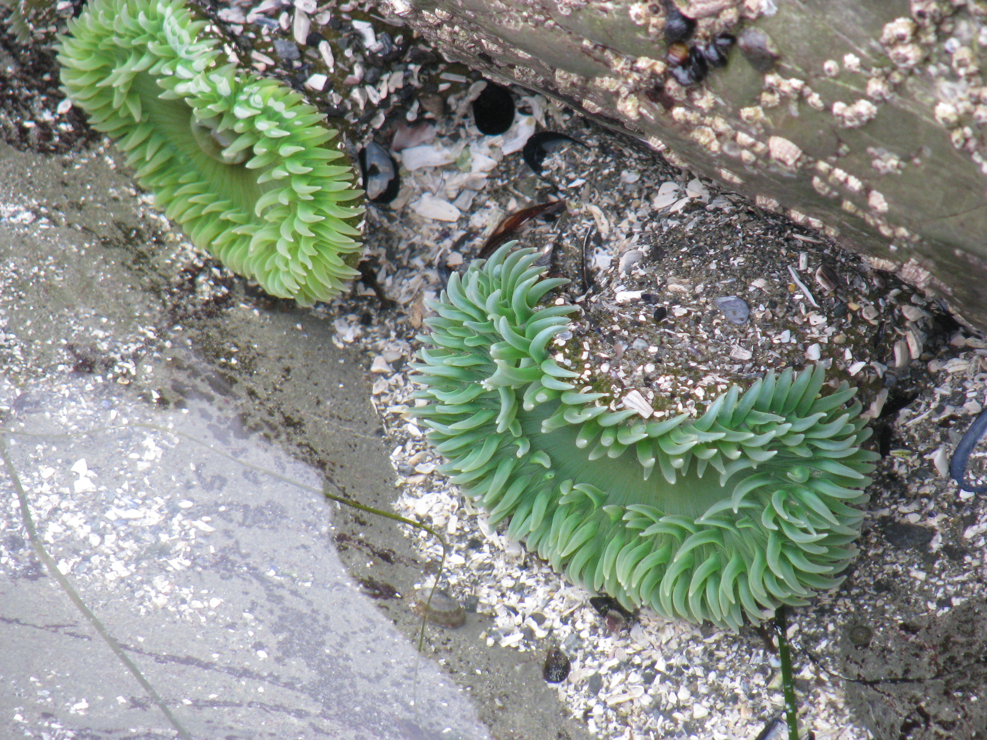 By this point I was feeling a bit nervous about wildlife since there was nobody else in sight and no other footprints in the sand, and also I wasn’t sure how long I had before the tide started coming back in again and I didn’t want to risk getting cut off. So I went back to the not-choke-point area and spent some time poking at life forms in the tidal pools.
There was nothing else I wanted to do that I thought I could pack into the day, so I went back to Tofino for supper. Ate at a local spot called The Schooner. I was a bit put off by their prices and that none of their plethora of menus is all-day, but it was OK food anyway. I noticed they had an extensive breakfast menu so I planned to eat there tomorrow before heading home.
Returned to the resort and took a post-sunset walk on the beach to say goodbye, and called it a night.
End of the third and last full day at the beach. Today’s GPS track:
[gmap type=”satellite” width=”80%” zoom=”auto” center=”files” file=’__UPLOAD__/2009/10/20091015.kmz’]