Leaving New Brunswick
2011/09/14
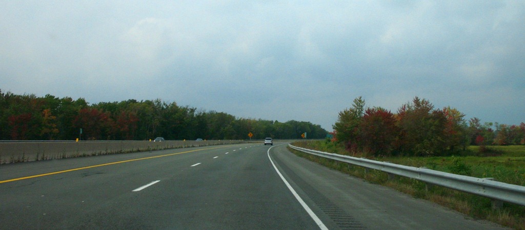
Today was mainly a driving day.
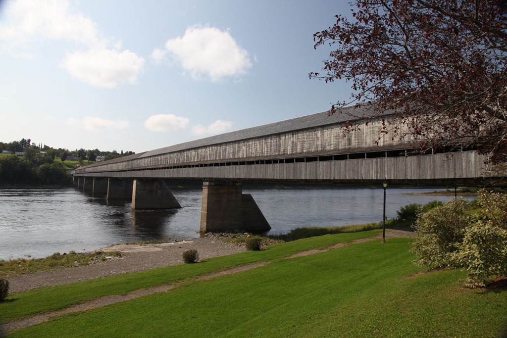
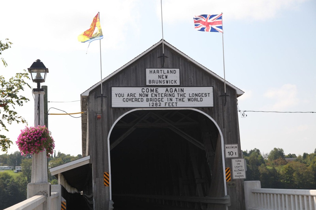
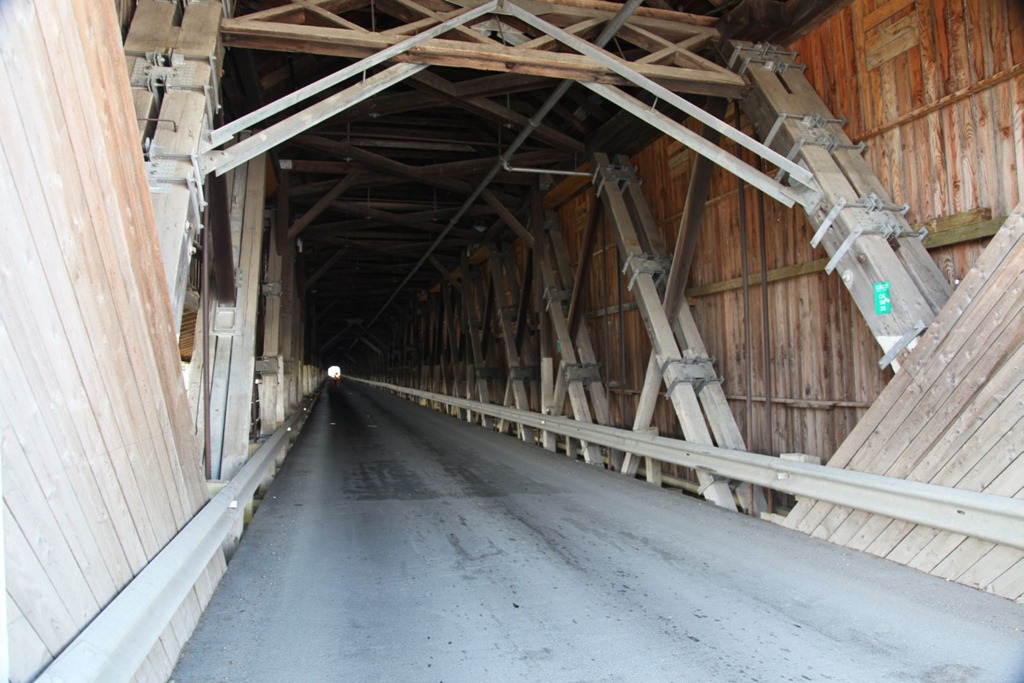
I stopped at the town of Hartland for a break, and saw their claim to having the world’s longest covered bridge:
I also noticed the first sign of fall colors today, which works out elegantly since part of the reason for the timing of my trip was the hope of seeing some reds and yellows on the trees during my return trip.
Not much else to say about today, but I remembered a few other things I wanted to say on other days:
Atlantic provinces, you like traffic circles a little too much. I like the single-lane traffic circles we have in some residential neighborhoods in Vancouver and other cities – they generally work better than having stop signs everywhere. But out here there are two- and three- lane traffic circles and they’re used for important intersections, and I find them confusing and dangerous.
Also, stoplight durations are way longer here than in the western provinces.
Secondly, I really like a lot of the place names in the eastern half of the country. Richibucto. Bouctouche. Manicougan. Chibougamau. Shubenacadie. Rustico. Pictou. Doak. Saint-Louis-du-Ha! Ha! (seriously). Temagami. I think the eastern tribes’ languages tended to induce some pretty nice names.
[gmap file=”__UPLOAD__/2011/09/20110914.kml” visible=”true” zoom=”auto” center=”files” type=”satellite”]
The Right Coast and Homeward Bound
2011/09/13
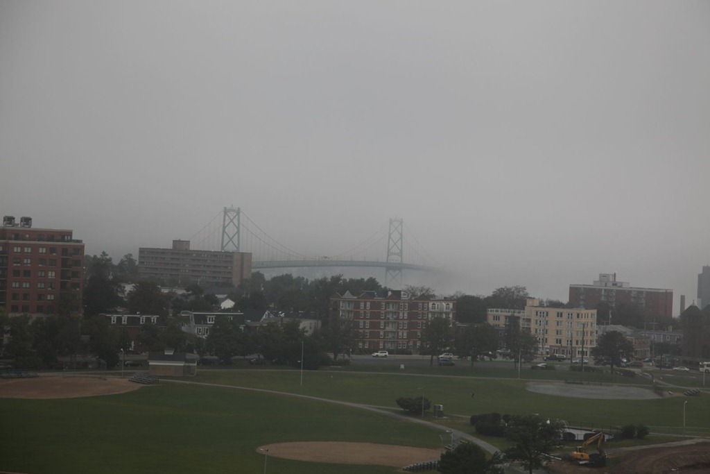
Today I woke up to find Halifax shrouded in fog:
My plan was to catch the 1pm ferry to Prince Edward Island, so I hit the road as soon as I could. Modulo a delay searching for a gas station, and picking up something to eat later on. I ended up being lucky; I arrived at the ferry terminal just as the boat was docking, but still managed to get aboard.
The ferries here are smaller than the ones in BC, but still have a pretty decent vehicle capacity.
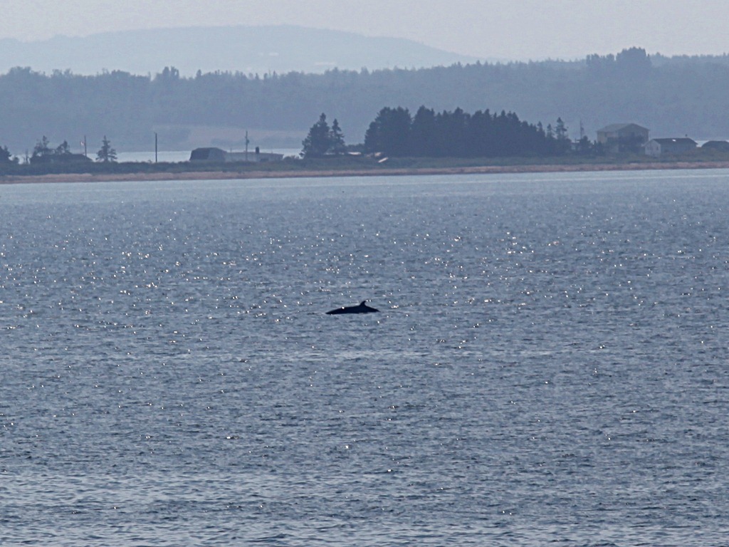
I saw my first wild whale. It was most of a mile away – this is an unscaled crop from a telephoto shot. I leave identifying the species to you.
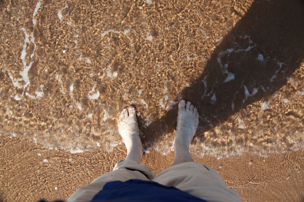
On arrival on the island, I had my lunch then drove through Charlottetown to Brackley Beach, which serves as the east coast analogue of Long Beach for this journey.
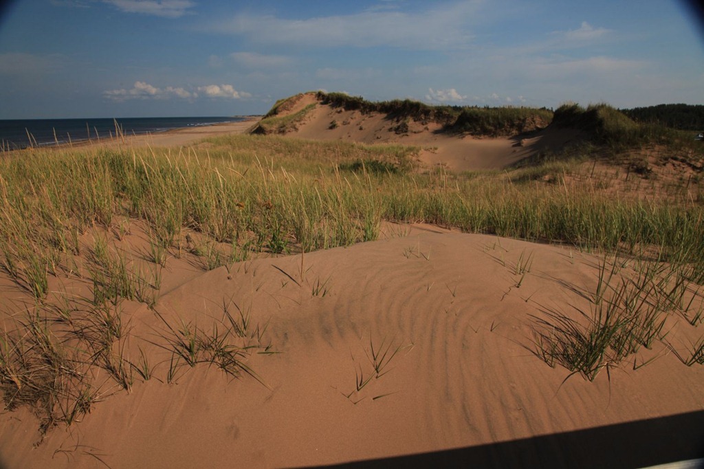
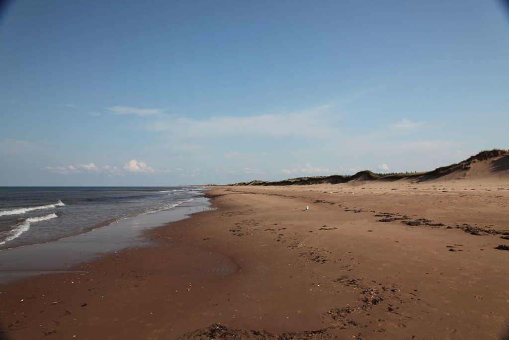
It is a pretty nice beach, with large sand dunes, soft sand and a good breeze. I took my shoes off and walked on the sand, and dipped my toes in the Atlantic.
And with that (cue music) the eastbound leg of my journey comes to an end.

As for my timelapse movie project, so far I’ve recorded 180,000 frames and the camera is still holding out.
Westbound
Time to turn around and head home.

I’m actually excited to be heading back. It’s a very similar feeling to when I started my trip, only instead of the flavor of visiting old haunts with an aftertaste of new discovery, this time it’s the other order with a final sweetness of homecoming. I’ll be going faster on the return trip, but I do have a couple of short layovers planned. Ottawa is the first.
Anyway, after leaving the beach, I took a short detour up the coast to Cavendish, home of Lucy Maud Montgomery of “Anne of Green Gables” fame. I’ve never read the books and I barely remember the TV series, but my mother is a fan so I thought I’d get her a souvenir. I got there just as they were closing, so I got in for free and got a bunch of photos of the place.
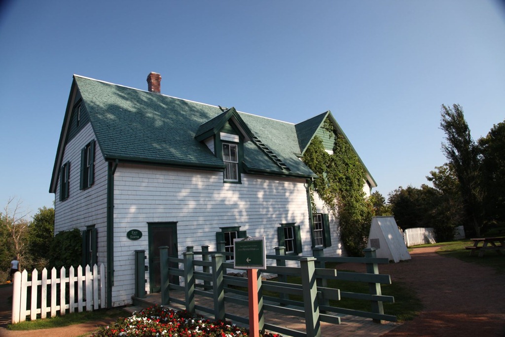
I thought this Green Gables house was a recreation of a fictional house from the book series, but talking to the tour guide, this turns out not to be the case. This is the real house that inspired the books; LMM lived a short ways from here but hung out in this house a lot. They’ve redecorated the interior slightly to make it match some details from the books, but otherwise it’s original.
Then drove back to Moncton for the night, passing over the Confederation Bridge on the way. It’s pretty nice. Only two lanes, but it is eight miles long. It’s like driving over the ocean, because that’s what it is.
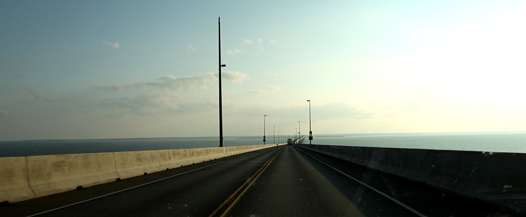
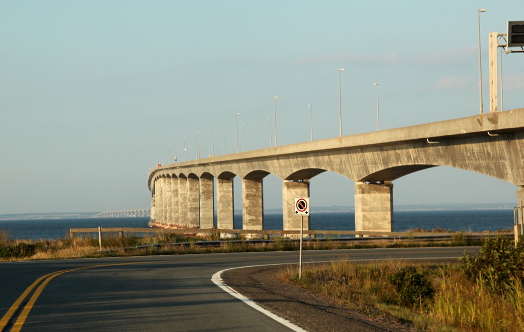
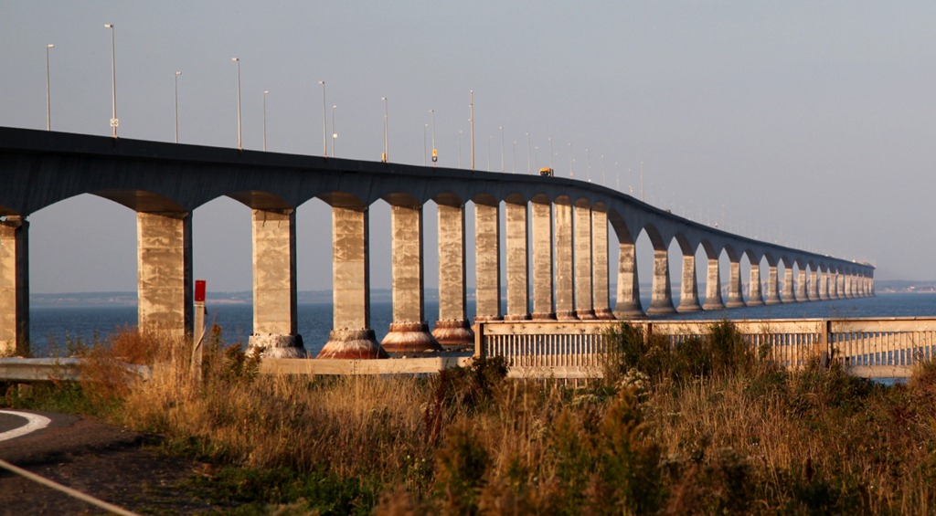
We really should get one of these for Vancouver Island. Problem with this one is the $45 toll, which is subsidizing the ferry service down the coast – my boat ride was free; they get you on the way back, whichever way you go.
Today was a bit of a long day, but amazingly everything went according to my ridiculously ambitious plan.
[gmap file=”__UPLOAD__/2011/09/20110913.kml” center=”files” zoom=”auto” visible=”true” type=”satellite”]
Halifax
2011/09/12
Short and easy drive to Halifax today. This is where my mother was born, though she didn’t live here for long.
Finding hotel rooms is easier now that kids are back in school; that first order of business was out of the way by 3pm.
Went downtown and had a quick look around. It’s a fairly small city, perhaps twice the size of Brandon, but it has a nicer downtown with some fairly old buildings:
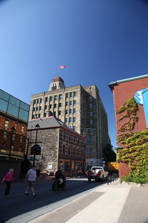
There is, of course, a harbour with cruise ships and two large bridges. It kind of reminds me of a mini-Vancouver actually.
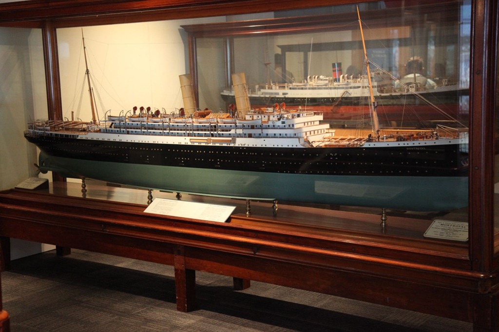
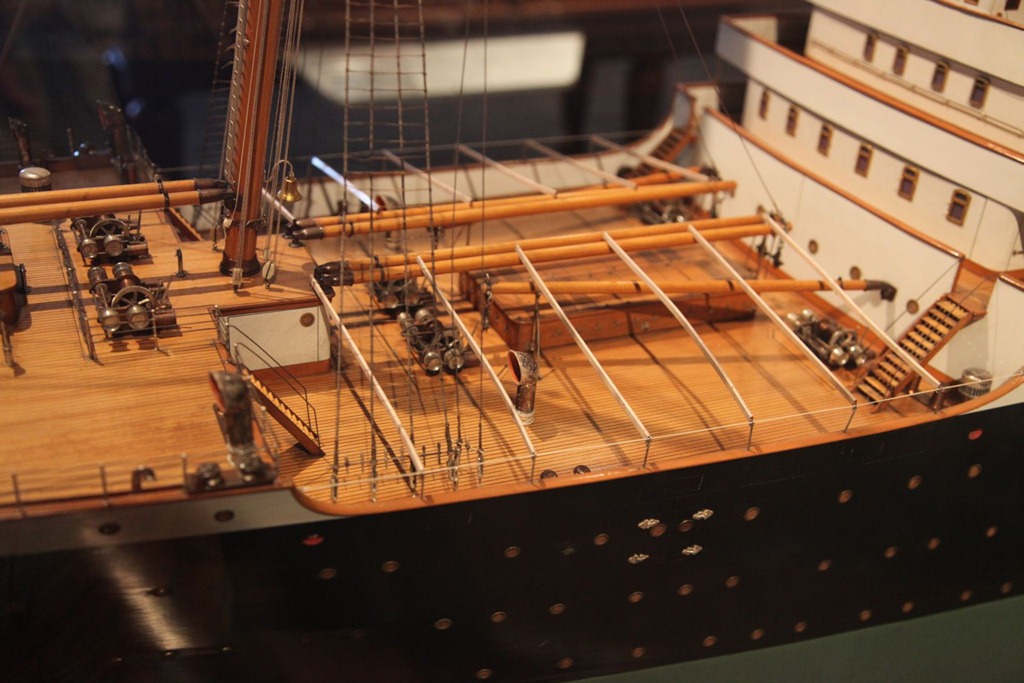
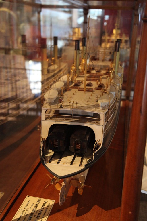
Went to the Maritime Museum of the Atlantic. It’s small but pretty interesting. They had temporary exhibits about the Titanic and about the early gay subculture amongst sailors (lending more depth to Smithers’s comment about women and seamen not mixing). But my favorite parts were the exhibit about the 1917 harbour explosion, and their collection of model ships, which I love. A few photos:

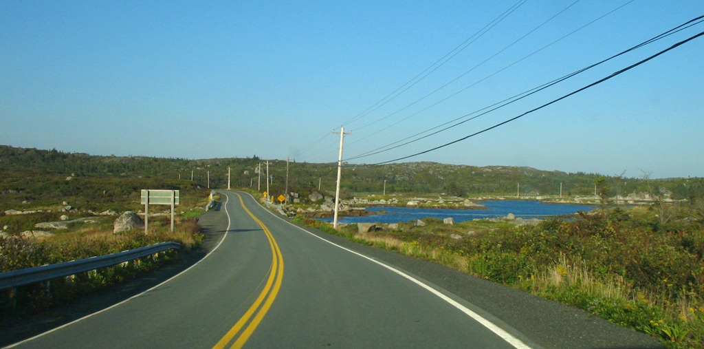
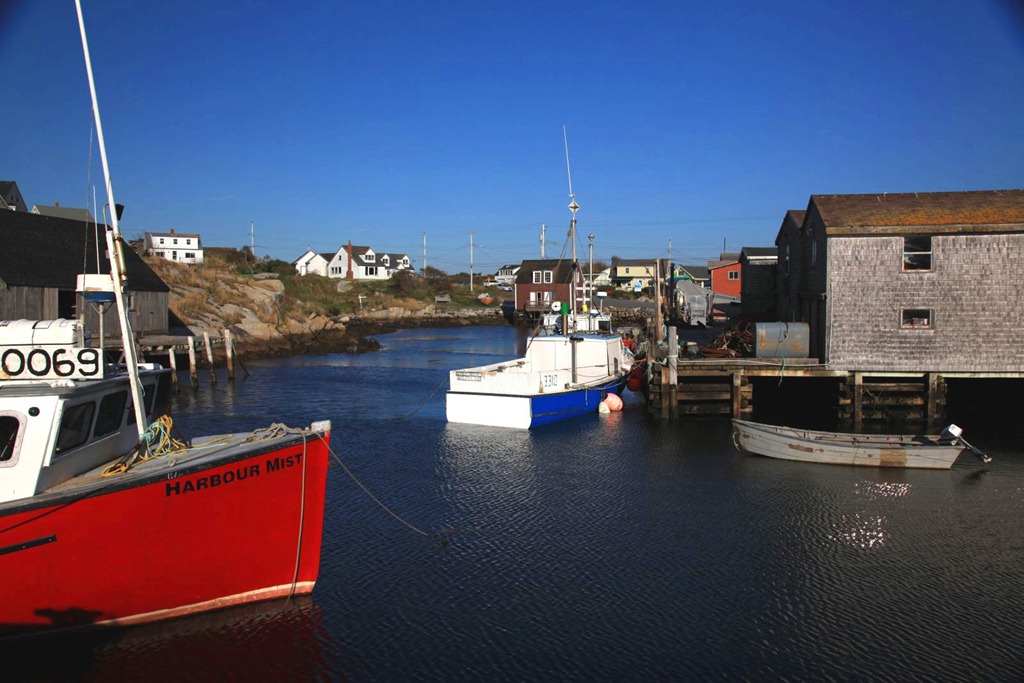
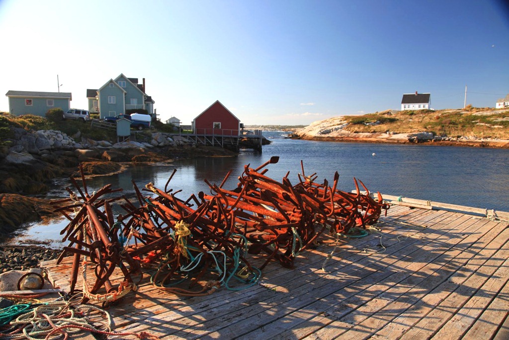
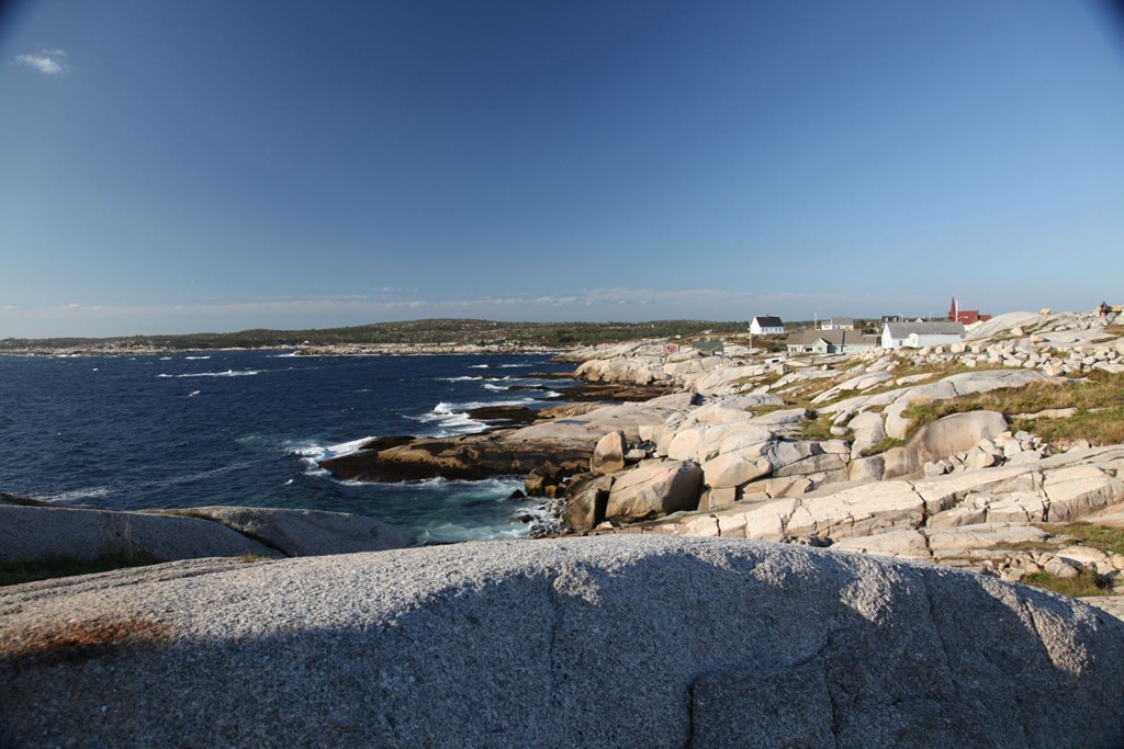
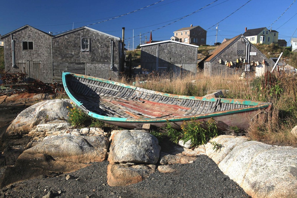
I then went to Peggy’s Cove, which is a small fishing village that contains Canada’s most-photographed lighthouse and is likely one of our most-photographed villages too. It’s every bit as picturesque as you might think, and I would say it’s a must-visit if you’re on the east coast. It’s about a 45-minute drive from Halifax, but I’m sure there are bus tours that go there.
It’s a very stark landscape – the rolling hills are all rock, carved by glaciers, and the land is littered with lichen-crusted boulders dropped by the glaciers. Ground cover is moss and low plants, with the occasional stand of small coniferous trees. It must get pretty bitter here in the winter and during storms.
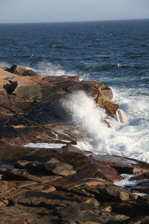
Assorted Peggy’s Cove pictures:

Near the lighthouse there was a young woman busking with bagpipes to earn college money. I gave her some money because I like bagpipe music.

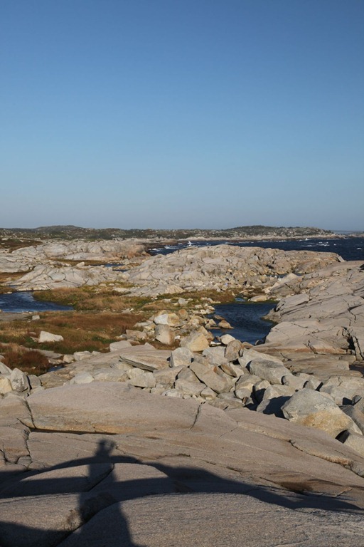
Self-portrait with landscape:
And today I’m feeling better about yesterday. I’m more confident now that skipping Newfoundland was a good decision, and also I talked to my parents about the location of the house near Harcourt, and we’re pretty sure I should have been able to see it given the distance I walked along the hydro lines; there’s nothing left of it now (it has been 35 years, after all).
[gmap file=”__UPLOAD__/2011/09/20110912.kml” center=”files” zoom=”auto” type=”satellite” visible=”true”]
Change of Plan
Two, actually, regarding my cross-Canada road trip.
The first decision I actually made about two weeks ago, and just haven’t mentioned it online yet. After driving around on gravel roads in Manitoba for a bit, I discovered that the Slaywagon doesn’t handle very well on gravel roads. I think the suspension is set wrong. I basically lose almost all control when on washboards.
Given that Labrador’s only through road (just completed last year!) is all gravel and frequented by transport trucks, I decided I really didn’t want to spend three or four days driving under those conditions. So I’ve scapped the idea of driving through Labrador. Perhaps some other time.
The second decision was more difficult. My sabbatical and vacation time is growing shorter, and going to Newfoundland would definitely make my return home late. It’s a six-hour ferry ride each way to the island, and then a twelve-hour drive from the ferry terminal to St. John’s. So if I wanted to spend a full day in St. John’s, which I do, it would basically cost me an entire week.
At present I have just enough time to get home and do the things I want to do on the return trip. I could book another week off work to make the Newfoundland trip, but I find I’m already looking forward greatly to the trip home and the things I wanted to do in Newfoundland are not sufficiently enticing to justify an extra week of travel.
Halifax and PEI will be sufficiently east coast to complete the eastbound leg of my road trip.
I am disappointed at not making it an “island to island” trip (Vancouver Island to Newfoundland) and at missing going to the easternmost tip of civilized Canada, but I think I can live with it.
If I end up dwelling on it in later years, I can fly out to St. John’s, rent a car and do Newfoundland and Labrador in a combined trip. This is what I’m telling myself, anyway. Hopefully it will work.
to Moncton
2011/09/11
Today was a short hop because there were two time-consuming side trips I wanted to make.
The first was to try and relocate an old home. When I was two years old my parents bought 50 acres near Harcourt, New Brunswick, and my father built an A-Frame house on it:
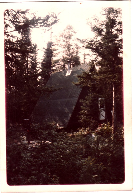
It had one room downstairs for living/kitchen/dining, and one room upstairs for sleeping. No running water – the outhouse was in the woods beside the house.
We lived here until I was four, at which point we moved to Calgary. Here’s me in the winter. That’s my dog Coal in front of me (she was born here) and the thing behind me is a “Big Scoop” snow shovel – the snow got deeper than I was tall here.

I have only a handful of memories from this place. My uncle Roland built a cabin of his own not far away. There was a stream crossing the laneway further down from us, and in the summer I remember seeing a horse leech (huge, disgusting thing) in there and in the winter the ice and snow covering the edges of the stream were beautiful.
Anyway, today I went to try and find the remains of the house. It was very difficult. First was a half-mile drive down Harley (“Hardly”) road, which looks like this now:
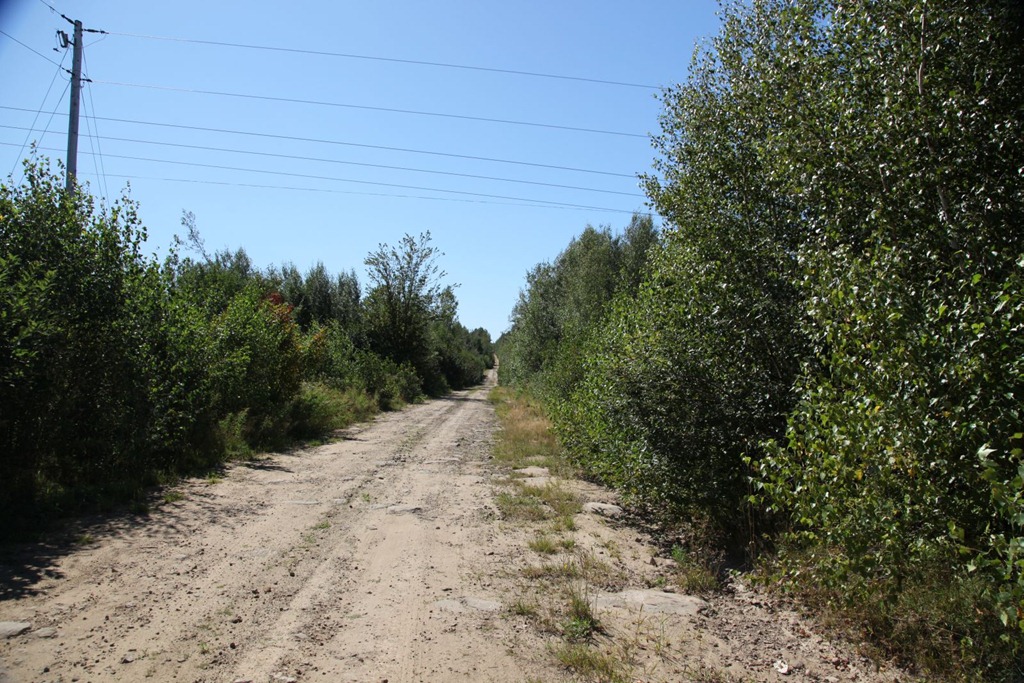
Then our house was some distance along the hydro line right-of-way. There was a laneway at the time, but the ROW now looks like this:
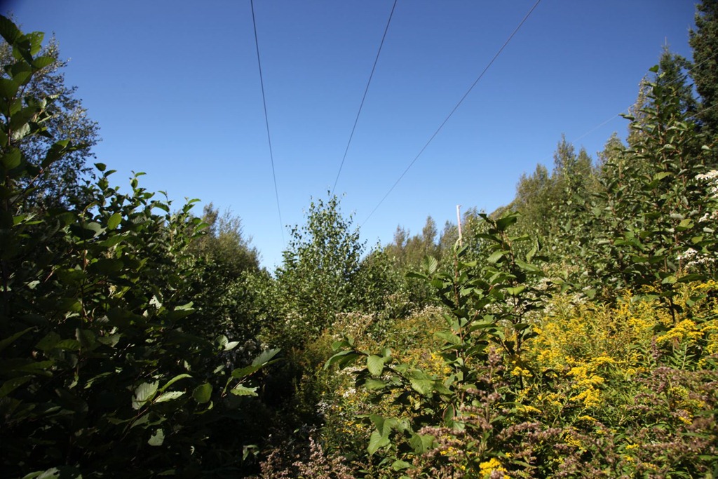
Young trees at just the right height to be a nuisance, and lots of tall plants. I slogged through this for perhaps 1/8 of a mile, but saw no sign of anything familiar. The going wasn’t getting any easier, and I was afraid of running into wild animals since there was nobody else around for at least half a mile. Perhaps I didn’t go far enough, but I doubt I would have spotted anything anyway. There was no sign of my uncle’s house either, and it should have been much more obvious.
My main memory from this place concerns the woods on the side opposite our house:

These woods are the only place I can remember ever getting lost. Once when I was three or four, I wandered in there and before long I realized I was disoriented and didn’t know which way led back to home. It was a little frightening since there’s nothing but more woods in most directions. This is the first case when I can remember deliberately employing knowledge and reasoning to solve a problem – I remembered roughly the direction of the sun when I went into the woods, and combining that with the certainty of which sides of the laneway and stream I was on, I was confident of which way I had to go to reach the laneway. And it worked. All told I was in there for perhaps an hour – definitely less than two – but it was scary and I resolved never to get lost again. And I haven’t. After that I put effort into developing my navigation and cartographic skills, and I maintain them to this day.
On the way to Harcourt, I passed a site I didn’t know existed: an internment camp. The base of the water tower is the only structure that remains now:

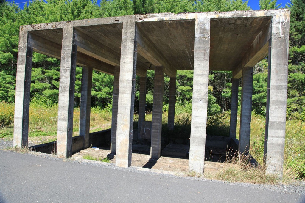
The sign says that Winston Churchill asked Canada to stow some Jewish refugees from Austria and Poland here for a while during WWII. After that, POWs were housed here – German and Italian merchant marines, and Canadian sympathizers including the Mayor of Montreal.
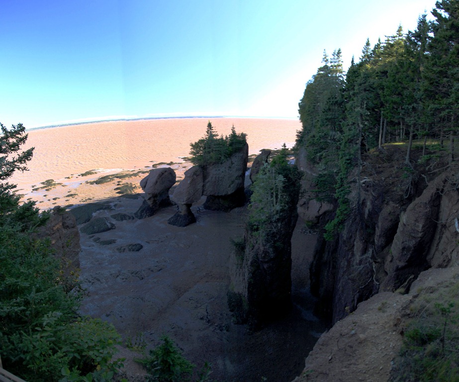
After getting my hotel room in Moncton, I headed further south to check out the Hopewell Rocks. Unfortunately the park was just closing as I got there, and I wasn’t allowed to go down and walk among the rocks. I did get some pictures from above, though the light was poor:
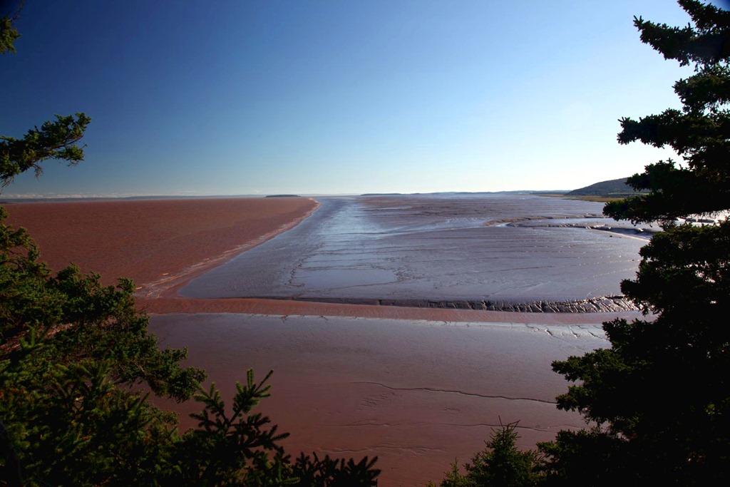
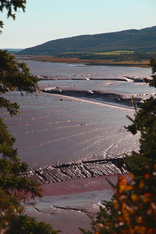
Further along the shore there is a huge mud beach. My photos don’t quite capture it, but all of this mud in today’s light looked just like melting chocolate – and it all comes from the equally brown Chocolate River, which looks like chocolate milk. Mmmm… chocolate…
I could sure use a Dairy Milk bar right now…
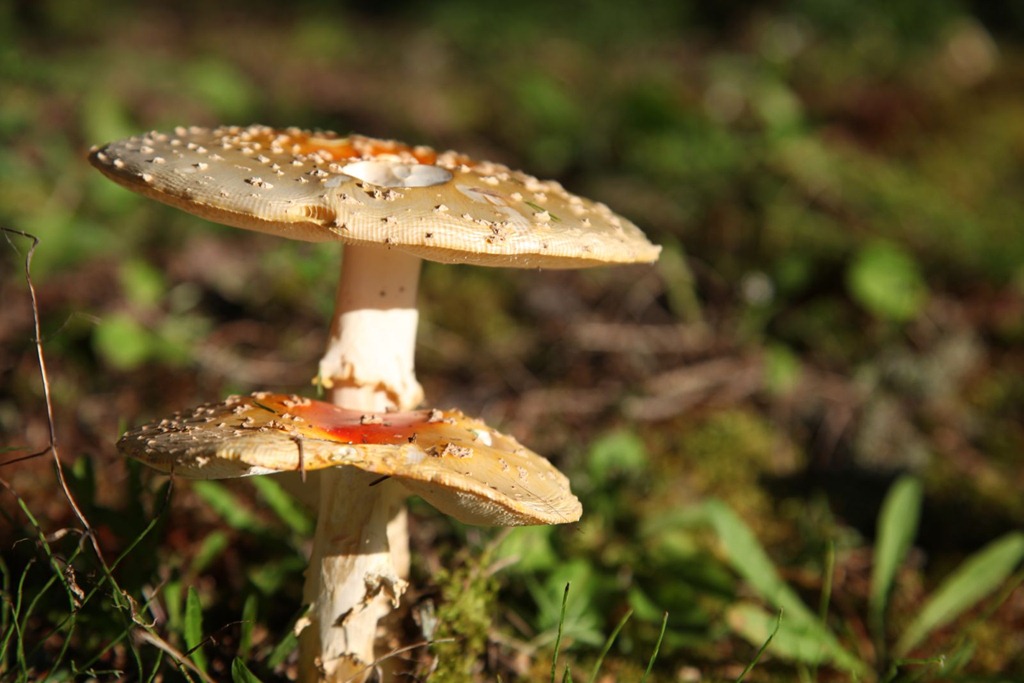
Also, Foadstools!
Overall today was a letdown – I couldn’t quite find the old house, I missed the best part of the Hopewell visit, and I made a disappointing decision that I’ll blog about separately. Trying not to let it all get me down too much.
[gmap file=”__UPLOAD__/2011/09/20110911.kml” zoom=”auto” center=”files” type=”satellite” visible=”true”]