to Saskatoon
2011/09/26
Wow, this was a long day. I was behind the wheel for nine hours today – by far the longest day on this trip in terms of driving time. Do not want to do that again.
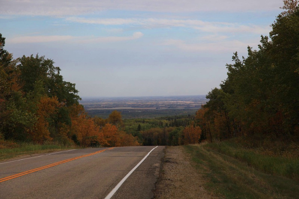
Left Wasagaming via the north exit from Riding Mountain park – here’s the view to the north.
I’ve only ever been this way once before, when my mother went to see some sort of motivational speaker in Dauphin and I went along for the ride. I don’t remember much about Dauphin at all, and I elected to bypass it this trip.
Next stop to the west was Roblin, which we went to several times while we lived at the farm. I don’t recall why we went there though. There was a playground I liked that had one of those fat, short, shiny slides – it got scalding hot in summer. And this building:
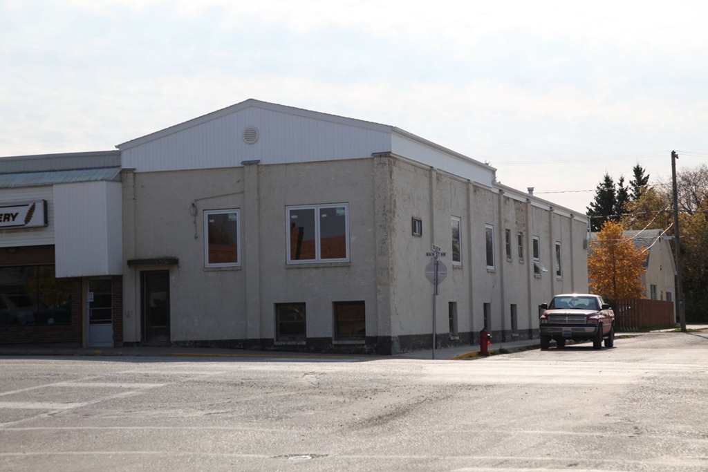
used to have an arcade in the basement. It’s the only place I have ever seen a Black Widow machine – that game was really hard to play. This is also either where I first played Stargate, or where I most played it. Mastering those space cadet controls was half the challenge.
On one of our trips to Roblin, I discovered a hard lump on my elbow. We went to a local doctorb to have it looked at. She said it was just a skin cyst and would grow out in a couple of years. Well, here I am more than twenty years later and it’s still there, unchanged. That’s how I know it’s a Thought Police tracking device. :)
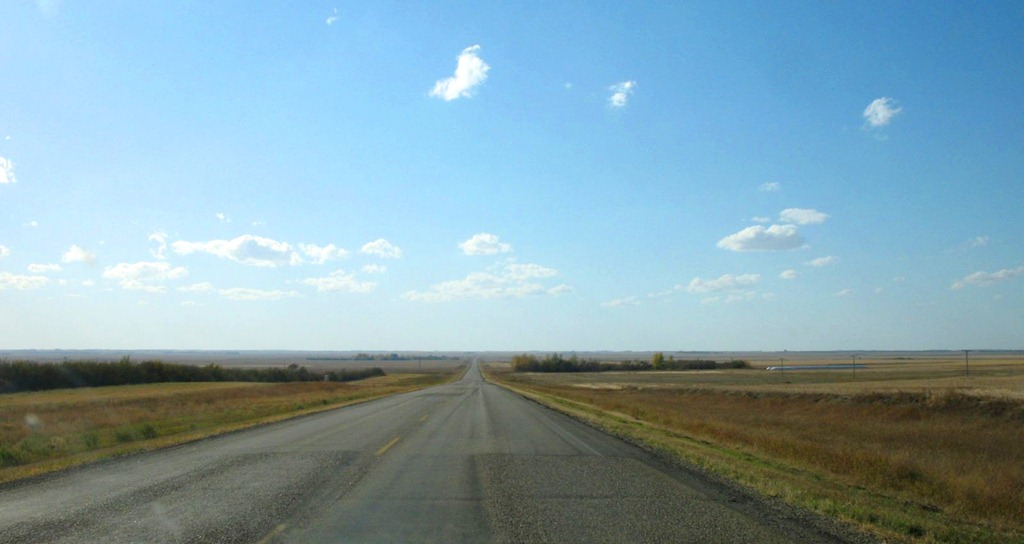
Moving on from Roblin, I stopped for lunch in Yorkton, then got on to what we called “the back way”, which was the most direct route between our farm and Calgary – mostly consisting of highway 15. It cuts straight across Saskatchewan, passing between Regina and Saskatoon. We liked this route because it was more direct, and had much less traffic than the more standard Trans-Canada or Yellowhead Highway routes. I wanted to revisit it at least partway for old time’s sake.
Well, it never was a terribly great road but now it’s in awful shape. Some sections have nasty pothole problems and sags from heavy grain trucks and farm equipment abusing it, and some parts have even been replaced with gravel – an improvement over the state of the adjoining paved sections.
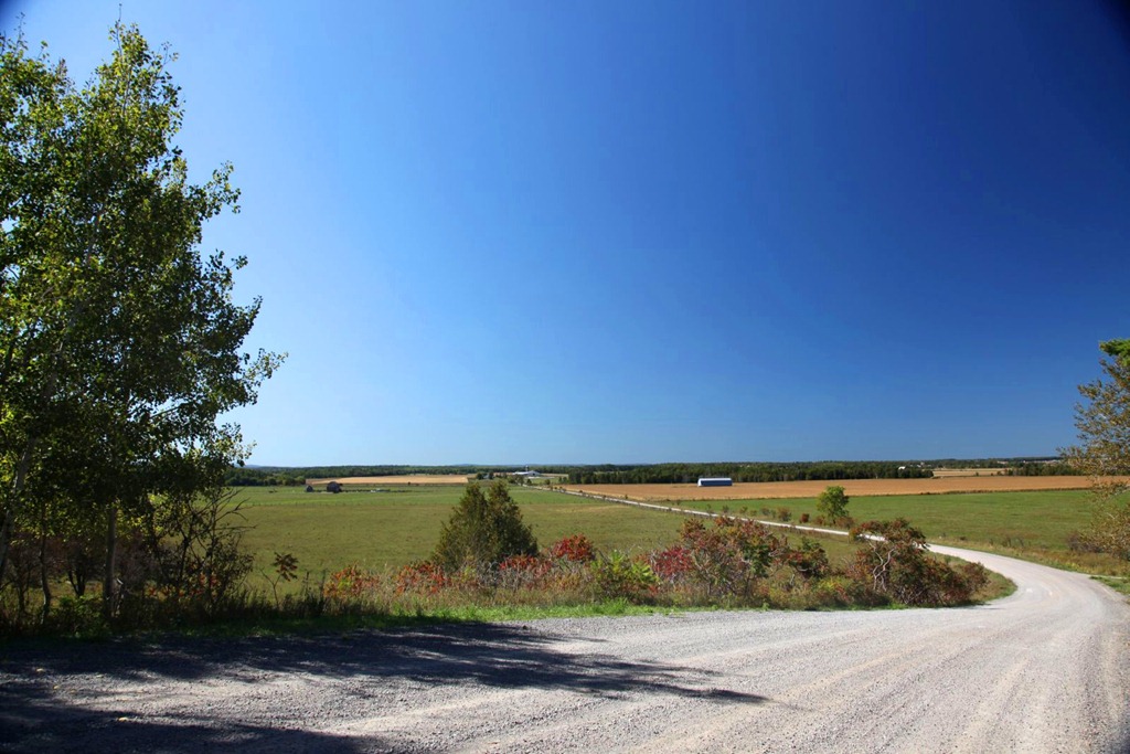
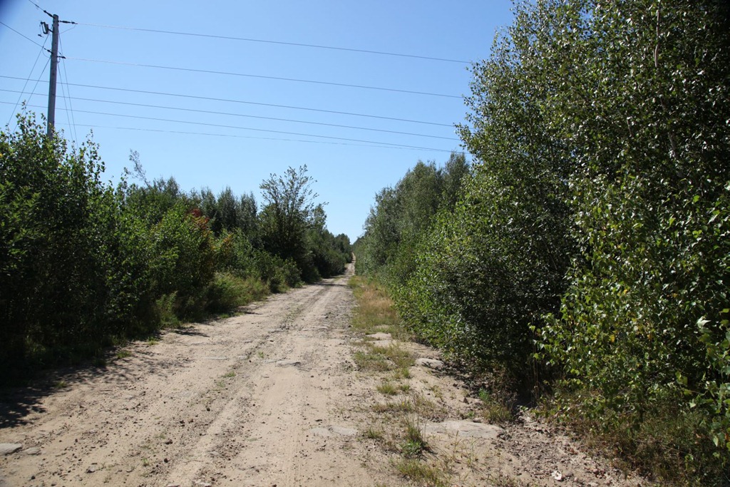
One thing I remember about this route now – it seemed interminable. That is still true. The road is very straight and very flat. It mostly looks like this:
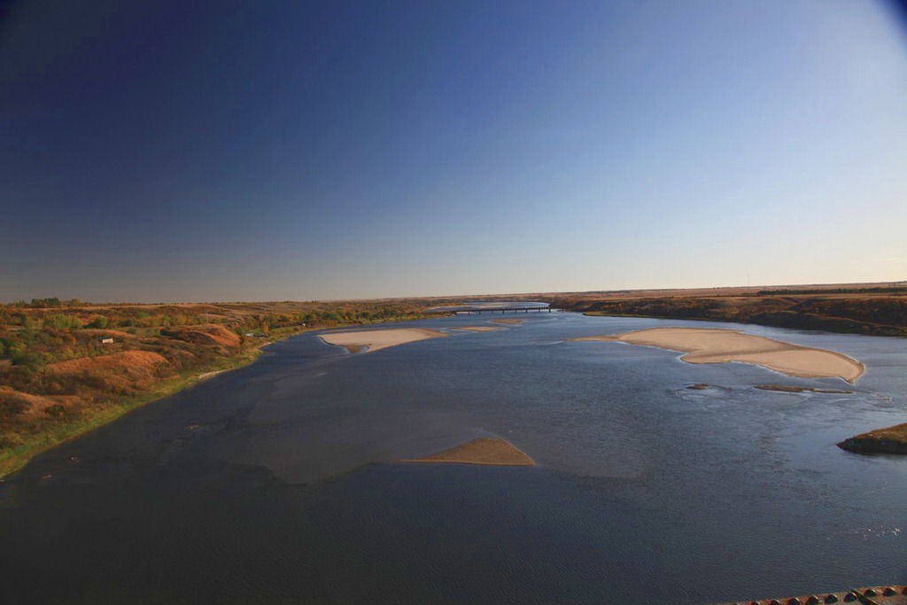
My destination for today was Saskatoon but I took a slight detour to visit the town of Outlook, because I wanted to rephotograph two landmarks there.
The first was a roadside… thingy… called Boot Hill – basically a fence with dozens of different kinds of boots nailed to it. I didn’t find it today, but perhaps I didn’t go quite far enough. Not a big deal.
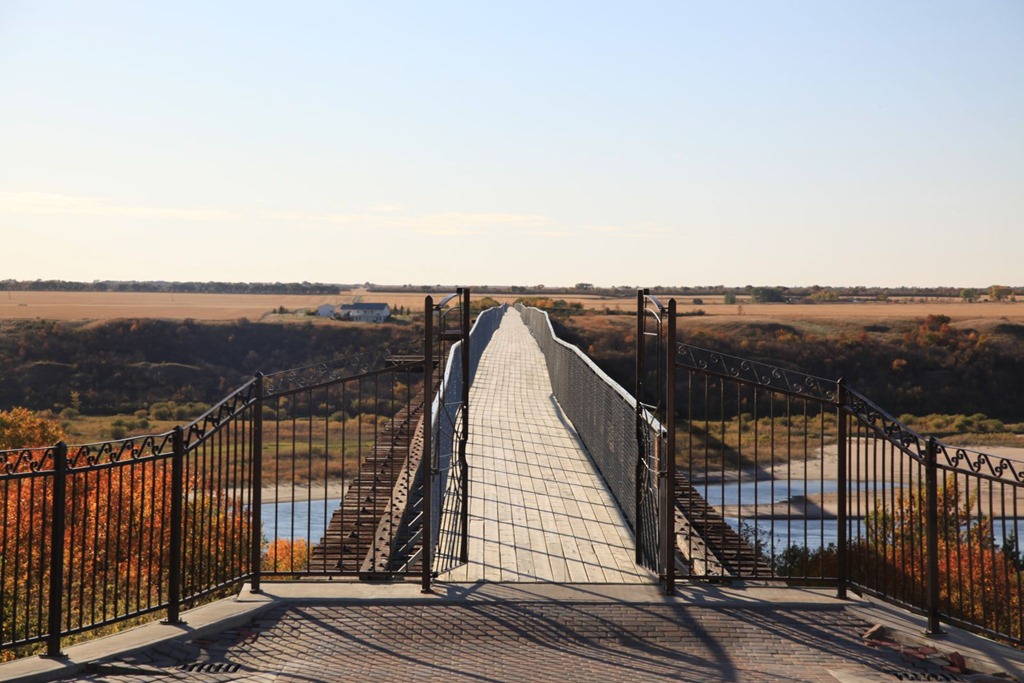
The second was the impressive train bridge over the river valley near the town:

The train tracks have been removed and it’s now the longest foot bridge in Canada – more than three quarters of a mile long. I think it might be part of the Trans-Canada Trail now.
Here’s the view from the town end:
And looking south from the middle of the bridge, towards where I took the first picture:
After that, I just continued on to Saskatoon and got my room for the night.
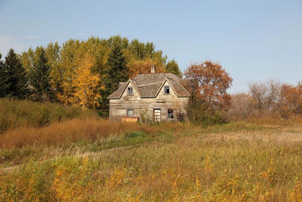
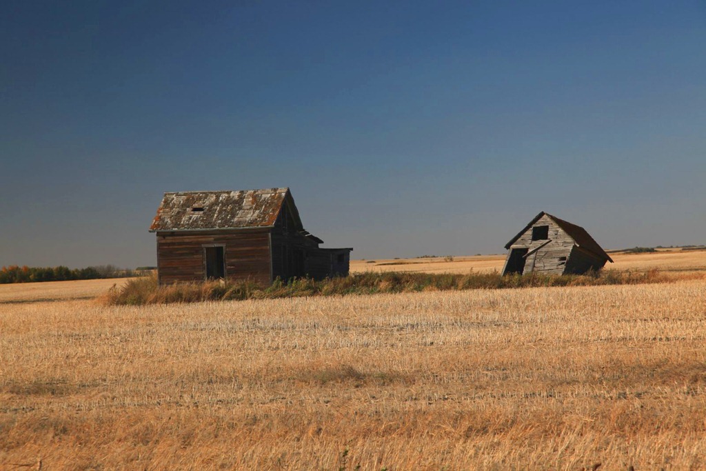
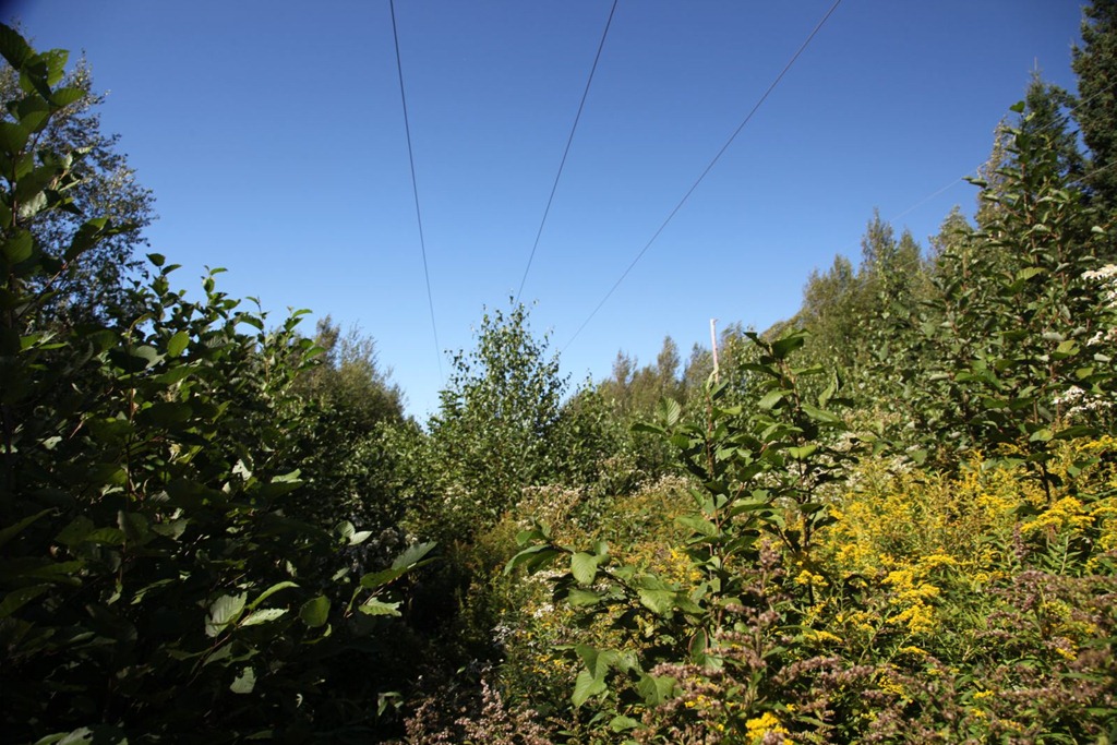
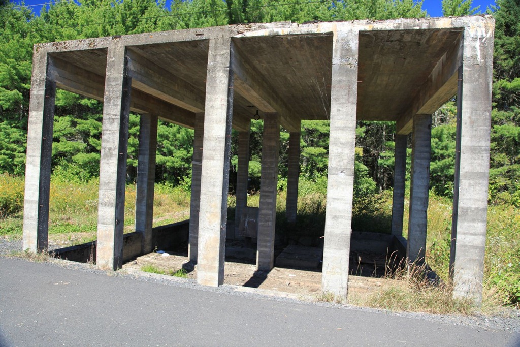
Here are a couple more prairie ruins for you:
[gmap file=”__UPLOAD__/2011/09/20110926.kml” visible=”true” type=”satellite” zoom=”auto” center=”files”]
to North Bay
2011/09/18
Drove from Ottawa to North Bay today. Two stops along the way.
First was Cobden, Ontario. We lived on a farm a couple of miles outside of town, briefly, when I was a toddler. I’m pretty sure the house was located near one of the barns in this picture. It’s no longer there.
My earliest memories come from this place. It’s where I said my first word, which was, of course, “tractor” – I’ve always been easily impressed by big, noisy machines.
One or the other of my parents would drive up this hill to go into town for supplies. I used to get upset when one of them left, and the other would sing to me – I still remember some of the songs my father would sing. My mother used to sing too, but sadly I don’t remember that.
I remember there being a swing hanging from the ceiling in the room I spent most of my time in.
And that’s about all I remember; it’s surprising I remember anything at all from this place since I was between 1 and 2 years old.
There was a bee hive above the kitchen door and I was stung near my eye once. I’m told it swelled up pretty badly, but luckily no permanent damage was done.
In the winter we would follow the tree line behind that barn and go for a picnic in the snow – imagine sitting on a blanket on the snow (the kind of snow that makes styrofoam-like crunch sounds because it’s so cold out), drinking hot chocolate out of a thermos.
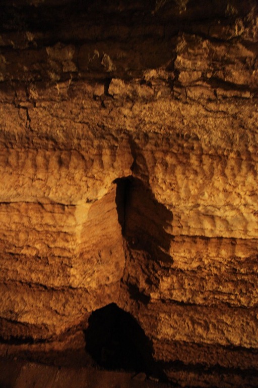
Less than a 30-minute drive away are the Bonnechere Caves – surprisingly, I don’t think we ever went to them before. Luckily I arrived just in time for a tour (you can’t go in the caves unless you’re on a tour). The tours are about an hour long. I really enjoyed this, and I highly recommend it if you’re in the area – just make sure you arrive in time for a tour.
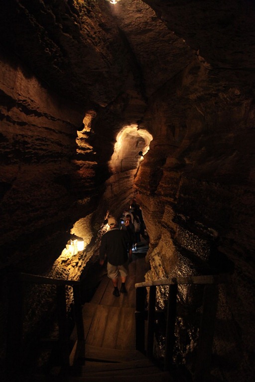
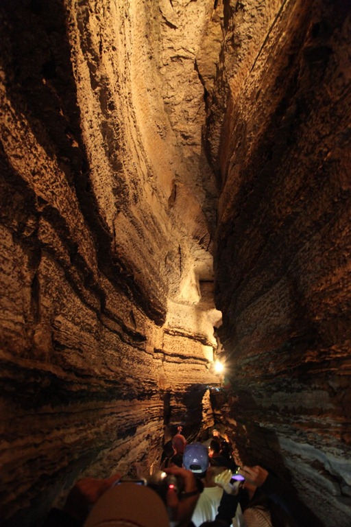
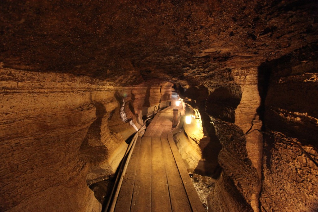
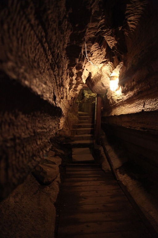
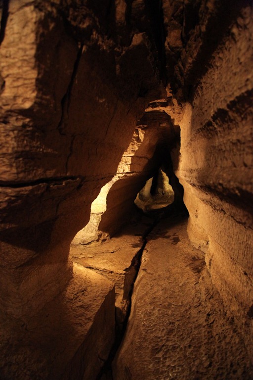
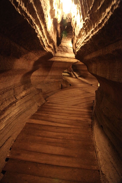
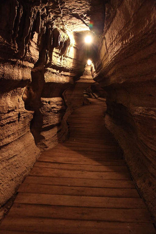
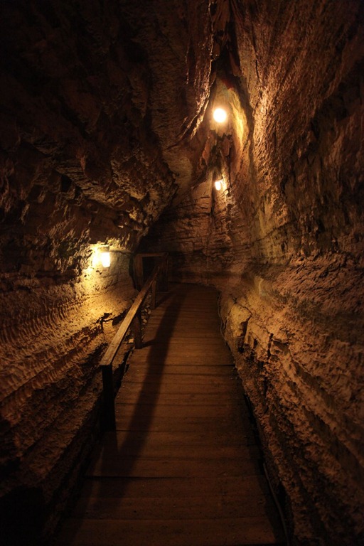

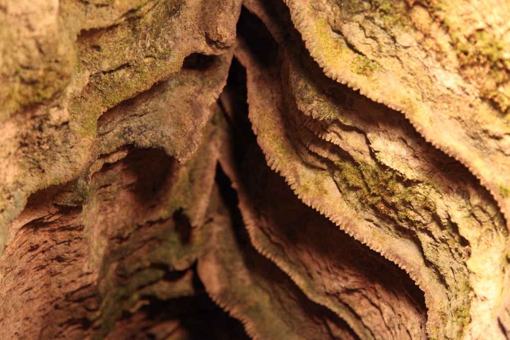
Cave teeth!
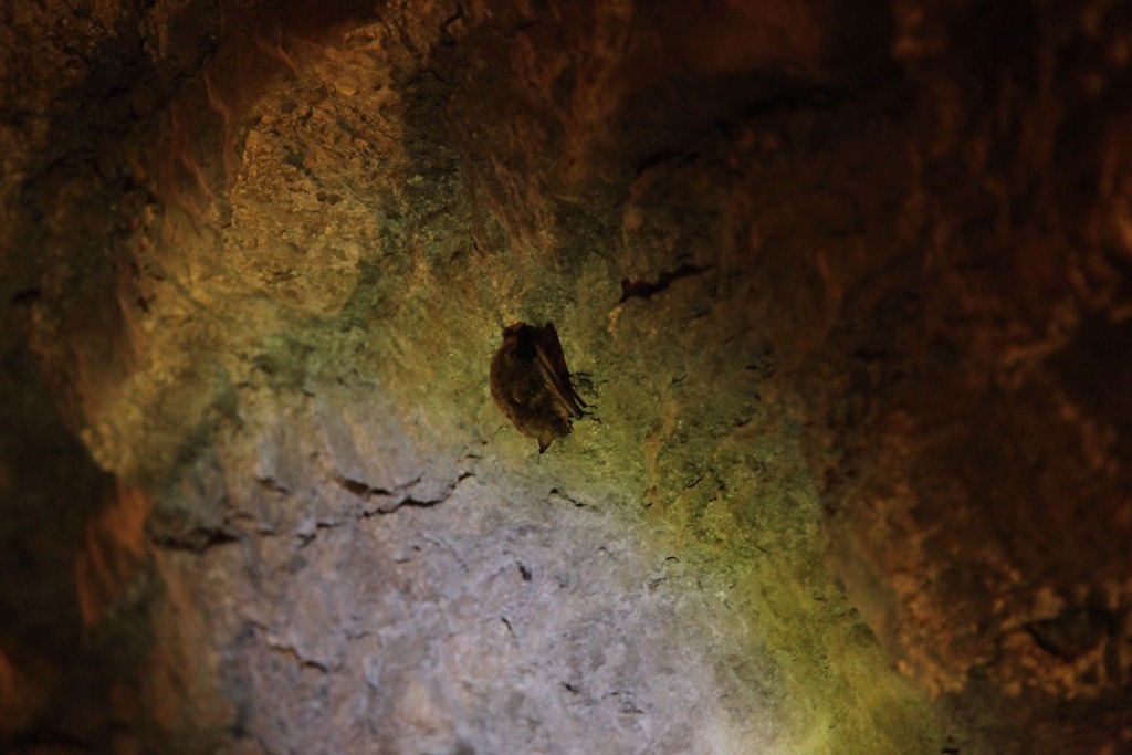
Cave bat!
Cave goatse!
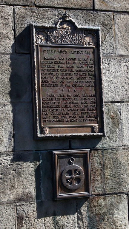
Outside Cobden was this interesting historical note:
And later on I also passed a plaque about the NPD Reactor, but not knowing anything about it I didn’t stop.
[gmap file=”__UPLOAD__/2011/09/20110918.kml” zoom=”auto” visible=”true” center=”files” type=”satellite”]
Ottawa day 2
2011/09/17
Today was all about hitting the local museums. I got a multi-museum passport that covers something like 11 of them.
Canadian Museum of Science & Technology
This was actually very much like the Ontario Science Center, though a bit smaller and with fewer interactive exhibits.
They had some steam locomotives that you could go inside the cabins of, which was cool.

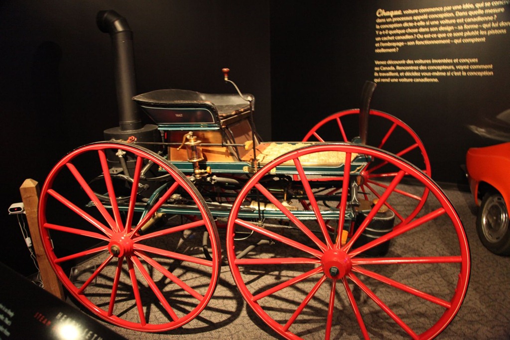
There was an exhibit on Canadian-made automotives. This one was steam-powered, manufactured by a jeweler and had no brakes:
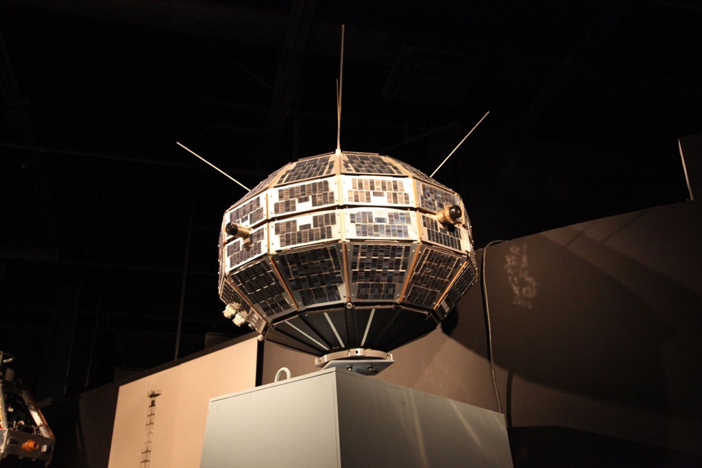
And I’m sure you all recognize this lovely little thing:
A mock-up of the cargo bay control area of the Space Shuttle (yes, with a Canadarm and no, you couldn’t move it):

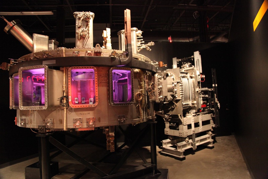
Mockup of a Tokamak fusion generator. Sadly nonfunctional, but it had pulsating purple lights inside, and that’s always impressive.
Quite a few other interesting exhibits, but like most educational museum-type stuff, not terribly photogenic.
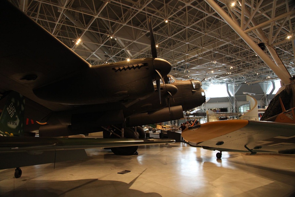
Canadian Aviation and Space Museum
Sadly I wasn’t able to get one of the biplane rides today, but for reference they do allow cameras on the flights. I wanted to take the flight over the parliament buildings. Oh well, next time.
The rest of the museum is pretty nice. Assorted pictures:
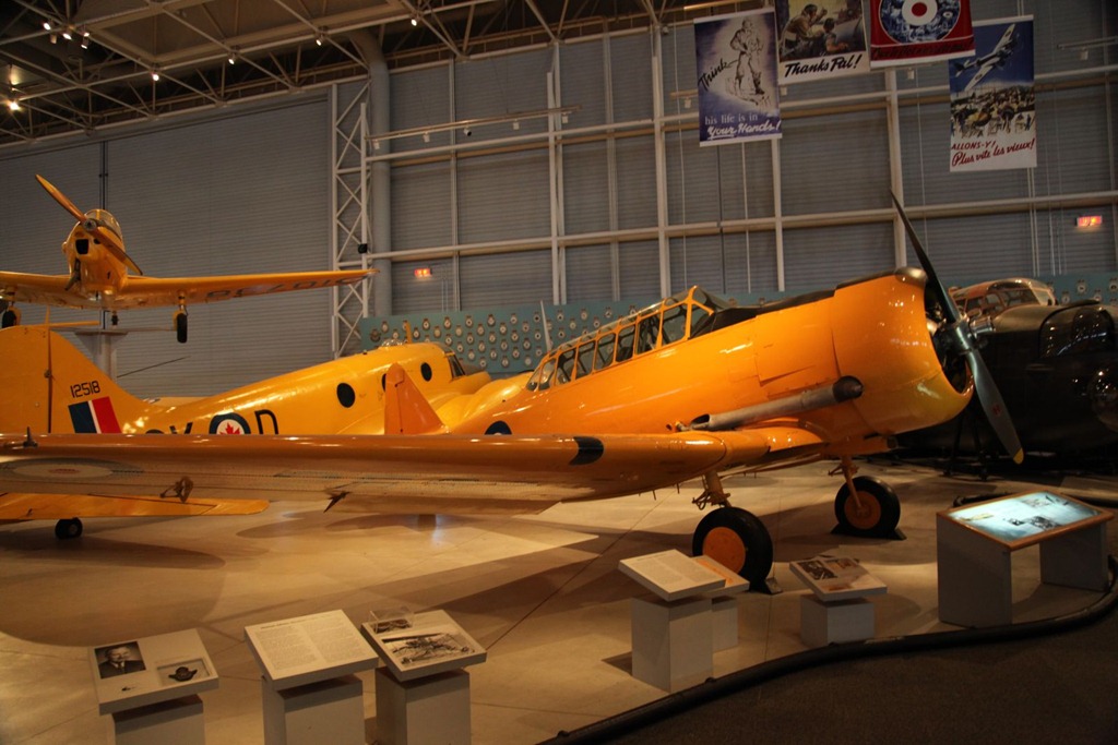
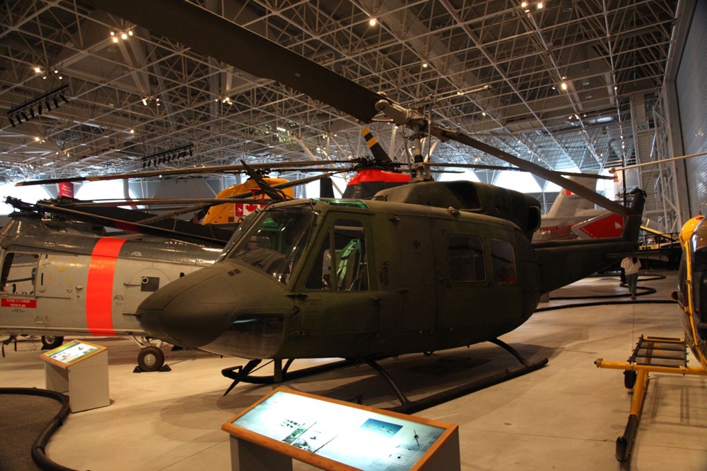

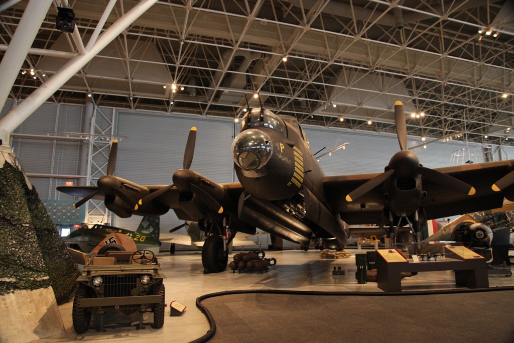
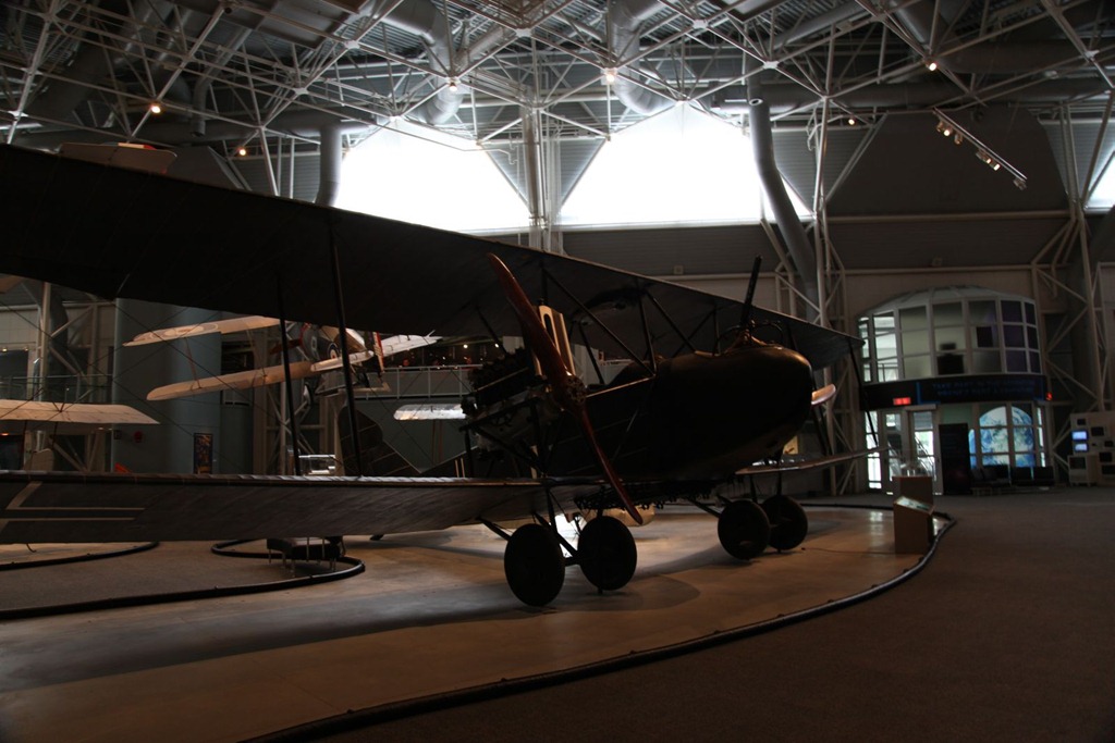
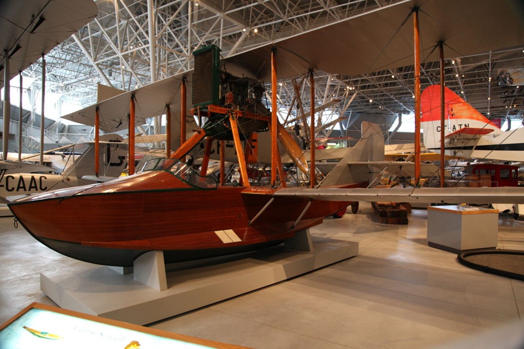
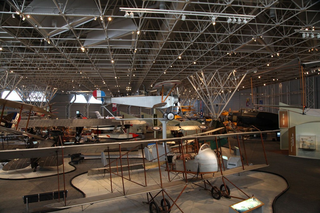
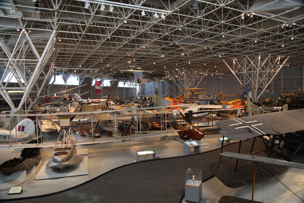
And yes, that hangar would make a great storage room, workshop and living space for me.
Canadian Museum of Civilization
Which includes the relatively small Canadian Postal Museum (mainly about the origins of mail delivery and postage stamps, with a very large collection of Canadian stamps) and Canadian Childrens’ Museum (mostly interactive stuff for kids).
It’s a decent museum, but…
I liked the postal museum especially,

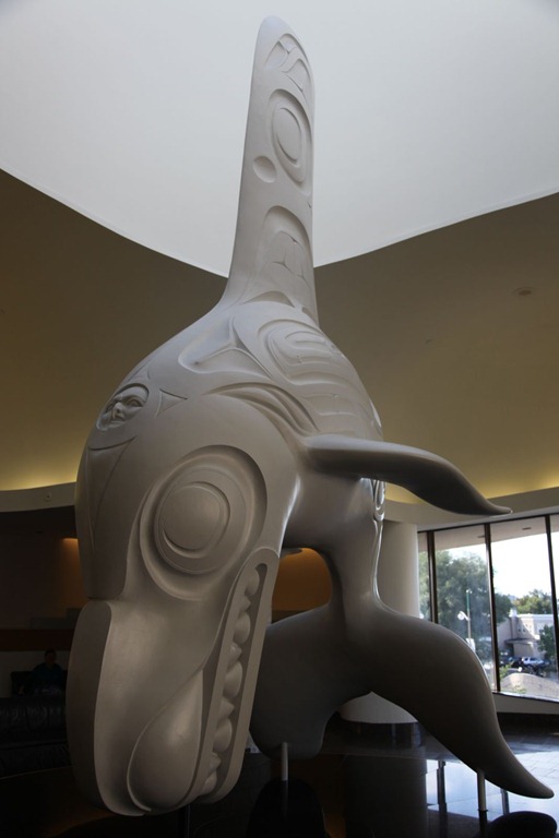
but the large section on aboriginal history didn’t interest me much,
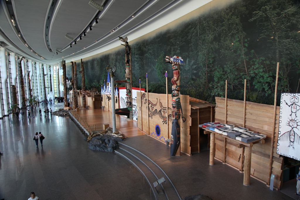
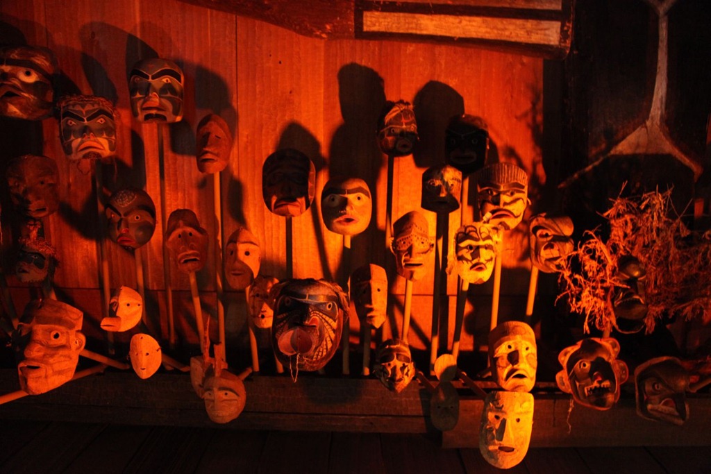
(although this looks awfully familiar):
and the well done Canadian history section was for me a repeat of the more authentic stuff I’ve seen at regional museums and places like Upper Canada Village, so I didn’t take a whole lot of pictures.
They did have an interesting temporary exhibit on Japan, but photos weren’t allowed in that section. That’s pretty typical of museums, I’ve found – no flash photography, and no photography in the temporary exhibits for some reason.
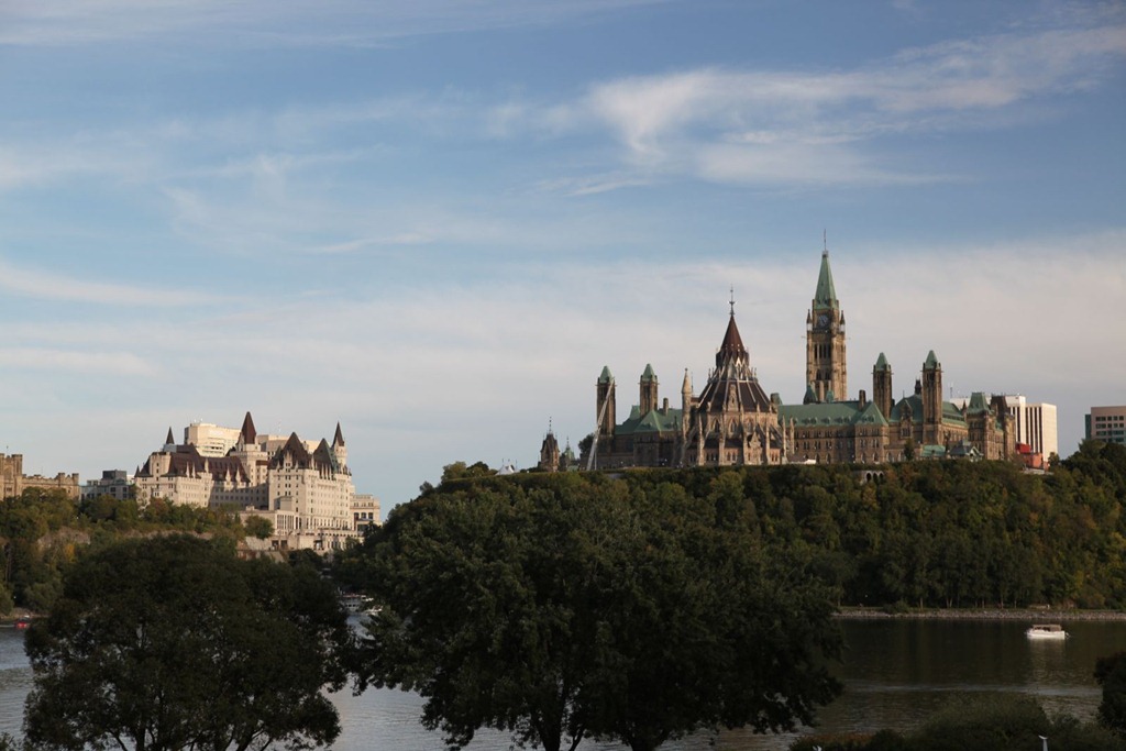
Shot of Parliament and the core hotel from the museum grounds:
And that pretty much ate up the whole day. Still a couple of museums, the art gallery and the mint that I haven’t seen, but they can wait for another visit, another time.
[gmap file=”__UPLOAD__/2011/09/20110917.kml” center=”files” zoom=”auto” type=”satellite” visible=”true”]
Ottawa day 1
2011/09/16
Short drive from Montreal this morning, got a room, then spent the day being a tourist.
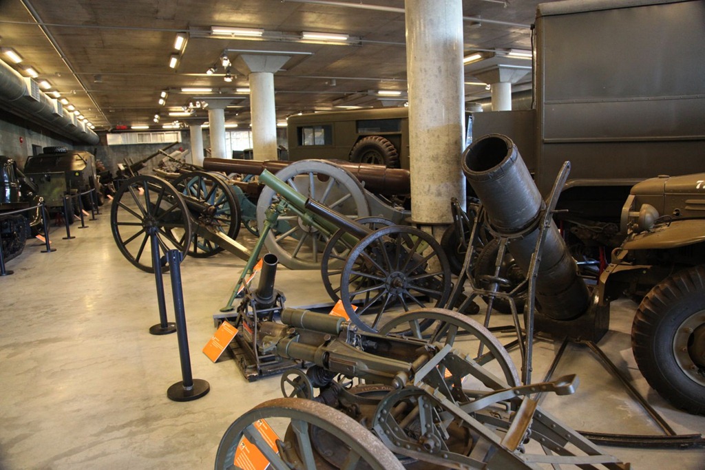
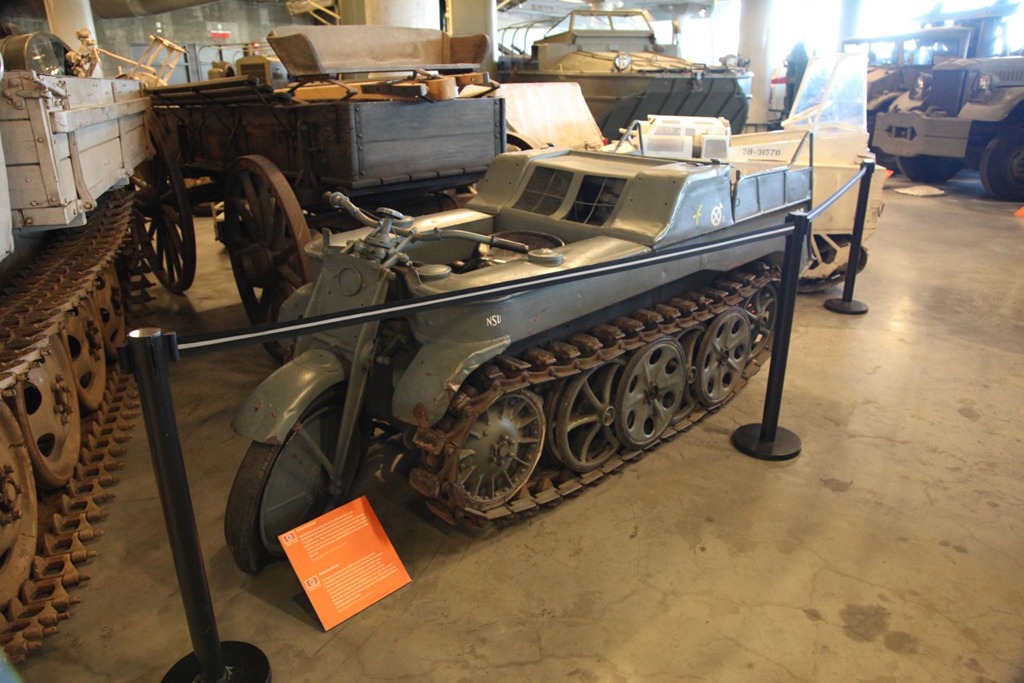
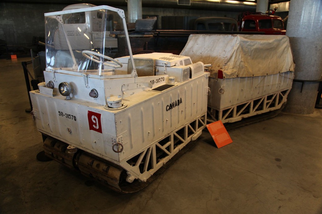
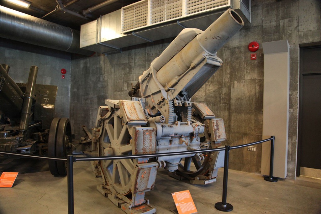
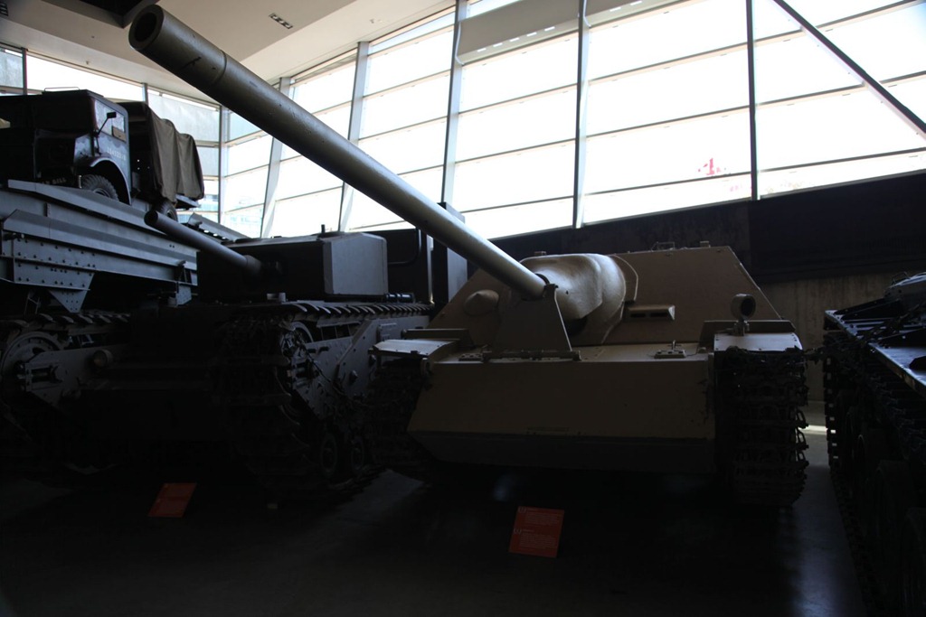
First stop: the Canadian War Museum. It was pretty interesting and I could easily have spent a whole afternoon there. They have a good collection of tanks and some rather odd vehicles for various countries. A few pictures:
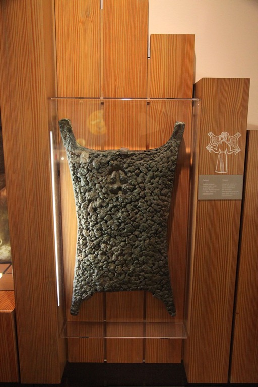
Next I went to the Currency Museum, which is free. It was pretty fascinating, actually – I took my time in this one. They have a great collection and it renewed my interest in coin and banknote collecting.
Here’s a couple of historic units of trade I had always wondered about, mostly thanks to reading the Asterix books. The first is a Talent, and the round ones are Sestertii.

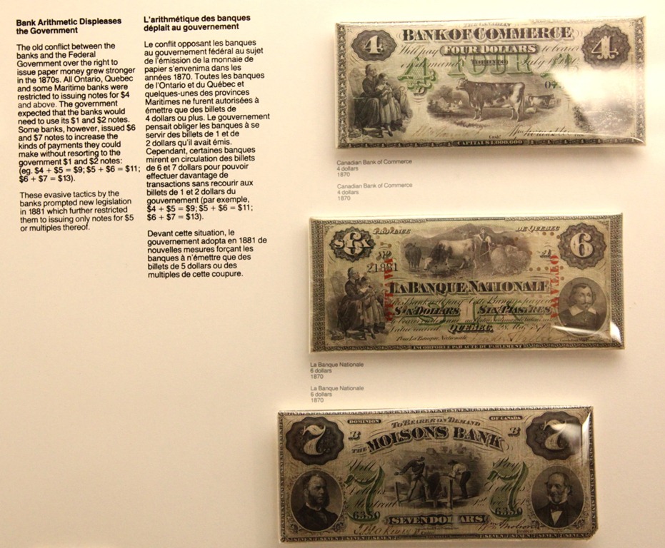
Early Canada had a lot of competing currency issuers. Many of them had to perpetrate some hacks or do outright illegal things in the interest of practicality or to get around overbearing regulations imposed from overseas. Witness the $4, $6 and $7 bills: (click for full size to read the legend)
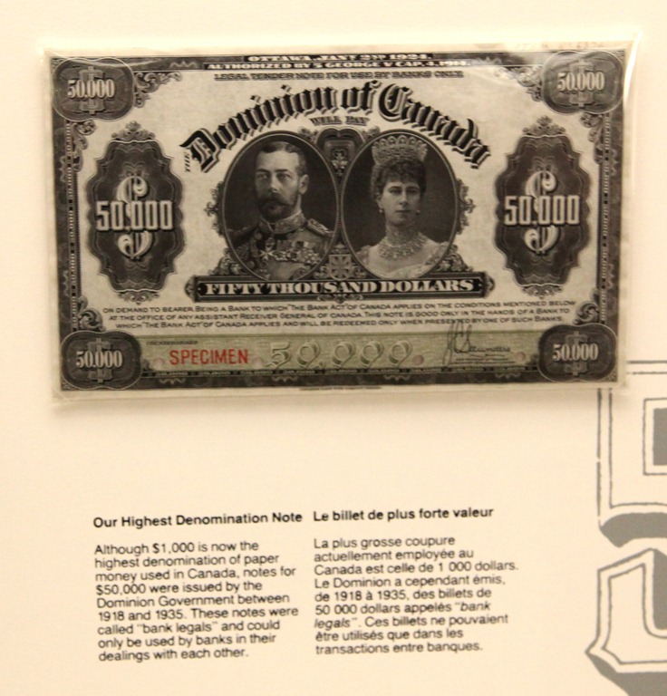
And here’s the largest legal banknote ever issued in Canada: $50,000, legal only for exchange between banks (ie not publically available).
I then went and walked around the Parliament buildings a bit:
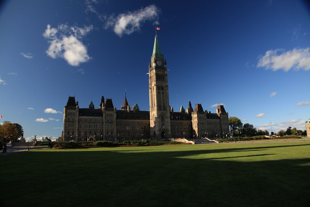
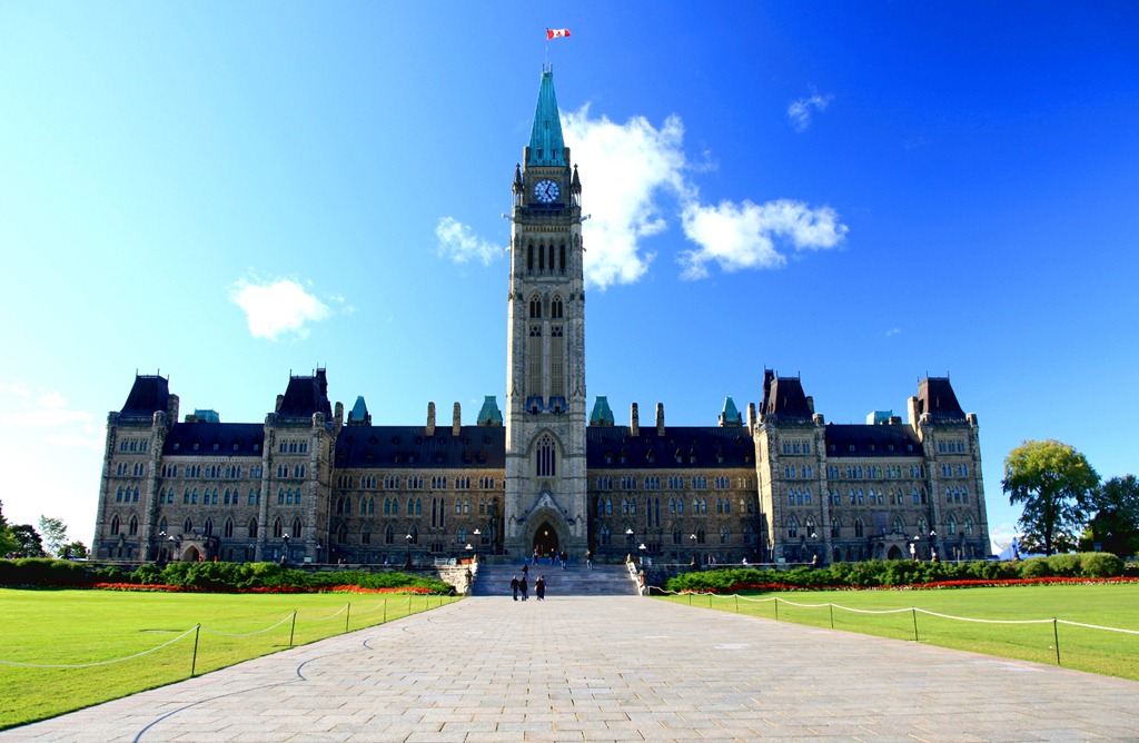
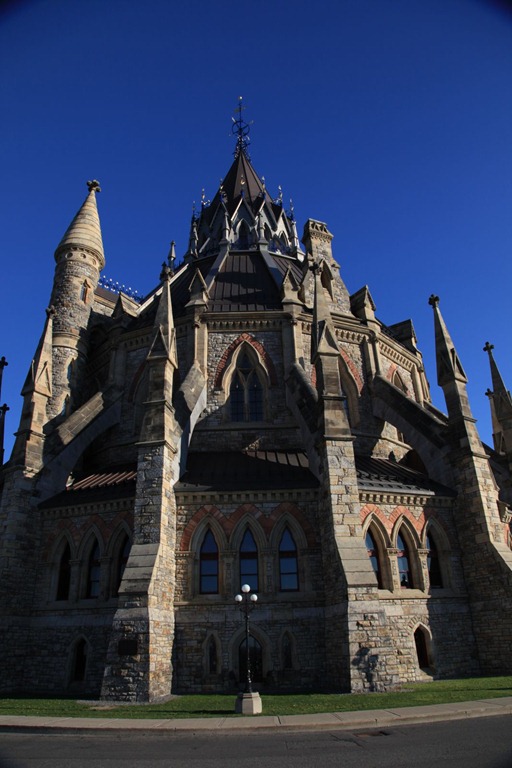
It’s a very, very nice building. I really like it – fantastic stone work. There are several other very nice, large stone buildings in the area too.
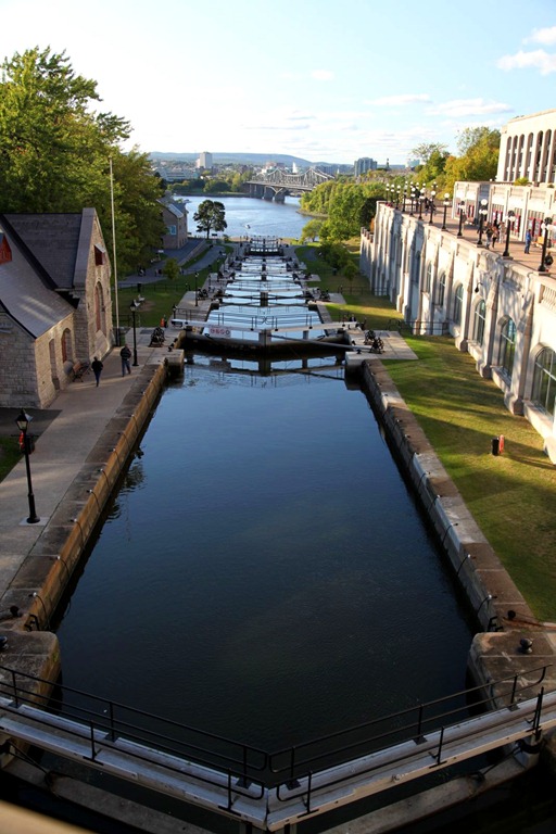
And here’s the Rideau Canal:
By this time all the tourist attractions were closed and I was hungry, so on the recommendation of a co-worker I ate at Chez Lucien, which is just around the corner from where he used to live in Bytown. It’s a small place but popular, and was super crowded. I had the Lucien Burger, which has bacon and cream cheese on it. It was pretty tasty – that’s actually a good combination.
[gmap file=”__UPLOAD__/2011/09/20110916.kml” center=”files” zoom=”auto” type=”satellite” visible=”true”]
to Moncton
2011/09/11
Today was a short hop because there were two time-consuming side trips I wanted to make.
The first was to try and relocate an old home. When I was two years old my parents bought 50 acres near Harcourt, New Brunswick, and my father built an A-Frame house on it:
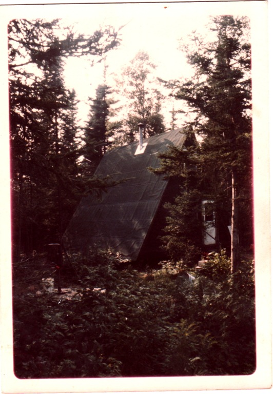
It had one room downstairs for living/kitchen/dining, and one room upstairs for sleeping. No running water – the outhouse was in the woods beside the house.
We lived here until I was four, at which point we moved to Calgary. Here’s me in the winter. That’s my dog Coal in front of me (she was born here) and the thing behind me is a “Big Scoop” snow shovel – the snow got deeper than I was tall here.

I have only a handful of memories from this place. My uncle Roland built a cabin of his own not far away. There was a stream crossing the laneway further down from us, and in the summer I remember seeing a horse leech (huge, disgusting thing) in there and in the winter the ice and snow covering the edges of the stream were beautiful.
Anyway, today I went to try and find the remains of the house. It was very difficult. First was a half-mile drive down Harley (“Hardly”) road, which looks like this now:
Then our house was some distance along the hydro line right-of-way. There was a laneway at the time, but the ROW now looks like this:
Young trees at just the right height to be a nuisance, and lots of tall plants. I slogged through this for perhaps 1/8 of a mile, but saw no sign of anything familiar. The going wasn’t getting any easier, and I was afraid of running into wild animals since there was nobody else around for at least half a mile. Perhaps I didn’t go far enough, but I doubt I would have spotted anything anyway. There was no sign of my uncle’s house either, and it should have been much more obvious.
My main memory from this place concerns the woods on the side opposite our house:

These woods are the only place I can remember ever getting lost. Once when I was three or four, I wandered in there and before long I realized I was disoriented and didn’t know which way led back to home. It was a little frightening since there’s nothing but more woods in most directions. This is the first case when I can remember deliberately employing knowledge and reasoning to solve a problem – I remembered roughly the direction of the sun when I went into the woods, and combining that with the certainty of which sides of the laneway and stream I was on, I was confident of which way I had to go to reach the laneway. And it worked. All told I was in there for perhaps an hour – definitely less than two – but it was scary and I resolved never to get lost again. And I haven’t. After that I put effort into developing my navigation and cartographic skills, and I maintain them to this day.
On the way to Harcourt, I passed a site I didn’t know existed: an internment camp. The base of the water tower is the only structure that remains now:

The sign says that Winston Churchill asked Canada to stow some Jewish refugees from Austria and Poland here for a while during WWII. After that, POWs were housed here – German and Italian merchant marines, and Canadian sympathizers including the Mayor of Montreal.
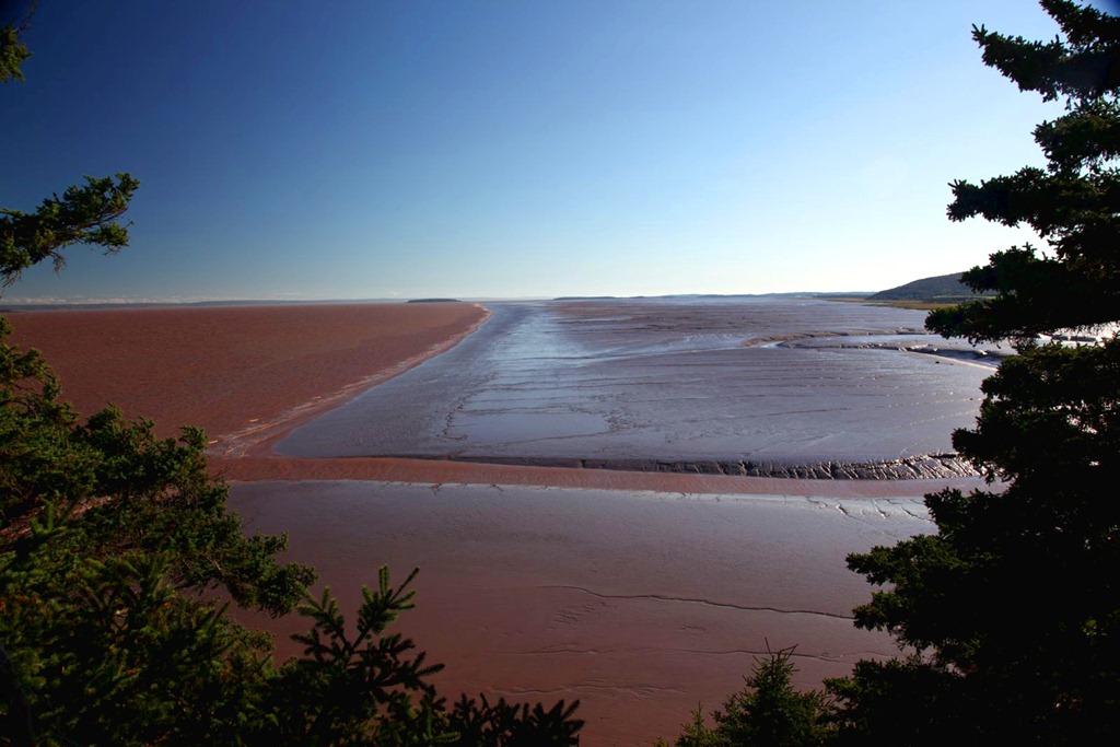
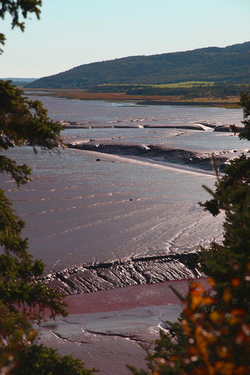
After getting my hotel room in Moncton, I headed further south to check out the Hopewell Rocks. Unfortunately the park was just closing as I got there, and I wasn’t allowed to go down and walk among the rocks. I did get some pictures from above, though the light was poor:
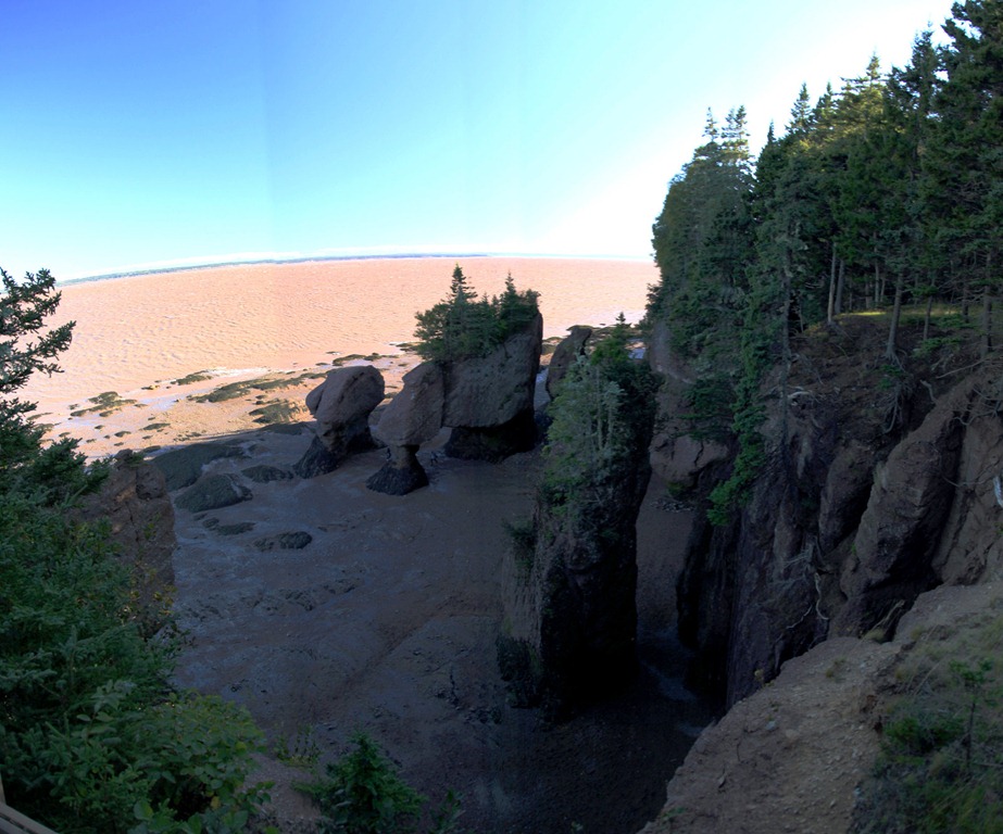
Further along the shore there is a huge mud beach. My photos don’t quite capture it, but all of this mud in today’s light looked just like melting chocolate – and it all comes from the equally brown Chocolate River, which looks like chocolate milk. Mmmm… chocolate…
I could sure use a Dairy Milk bar right now…
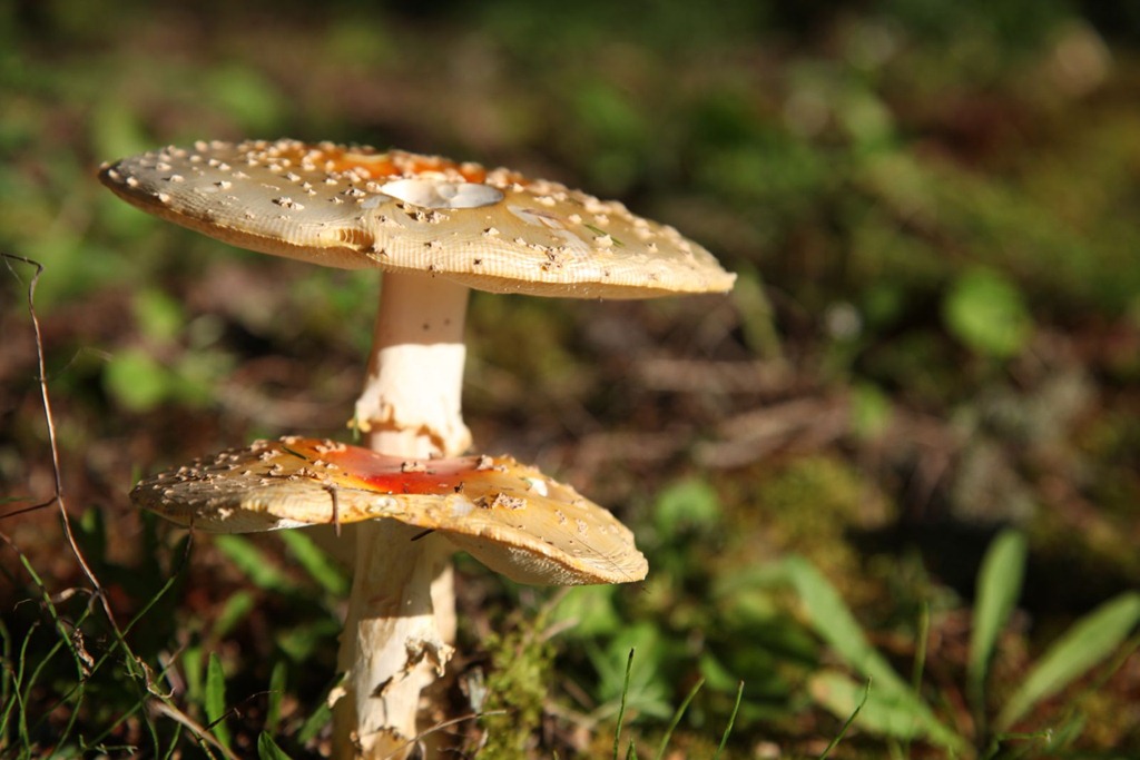
Also, Foadstools!
Overall today was a letdown – I couldn’t quite find the old house, I missed the best part of the Hopewell visit, and I made a disappointing decision that I’ll blog about separately. Trying not to let it all get me down too much.
[gmap file=”__UPLOAD__/2011/09/20110911.kml” zoom=”auto” center=”files” type=”satellite” visible=”true”]