to Moncton
2011/09/11
Today was a short hop because there were two time-consuming side trips I wanted to make.
The first was to try and relocate an old home. When I was two years old my parents bought 50 acres near Harcourt, New Brunswick, and my father built an A-Frame house on it:
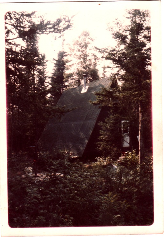
It had one room downstairs for living/kitchen/dining, and one room upstairs for sleeping. No running water – the outhouse was in the woods beside the house.
We lived here until I was four, at which point we moved to Calgary. Here’s me in the winter. That’s my dog Coal in front of me (she was born here) and the thing behind me is a “Big Scoop” snow shovel – the snow got deeper than I was tall here.

I have only a handful of memories from this place. My uncle Roland built a cabin of his own not far away. There was a stream crossing the laneway further down from us, and in the summer I remember seeing a horse leech (huge, disgusting thing) in there and in the winter the ice and snow covering the edges of the stream were beautiful.
Anyway, today I went to try and find the remains of the house. It was very difficult. First was a half-mile drive down Harley (“Hardly”) road, which looks like this now:
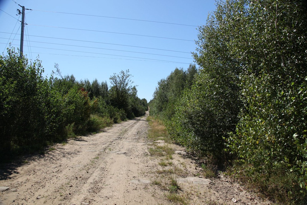
Then our house was some distance along the hydro line right-of-way. There was a laneway at the time, but the ROW now looks like this:
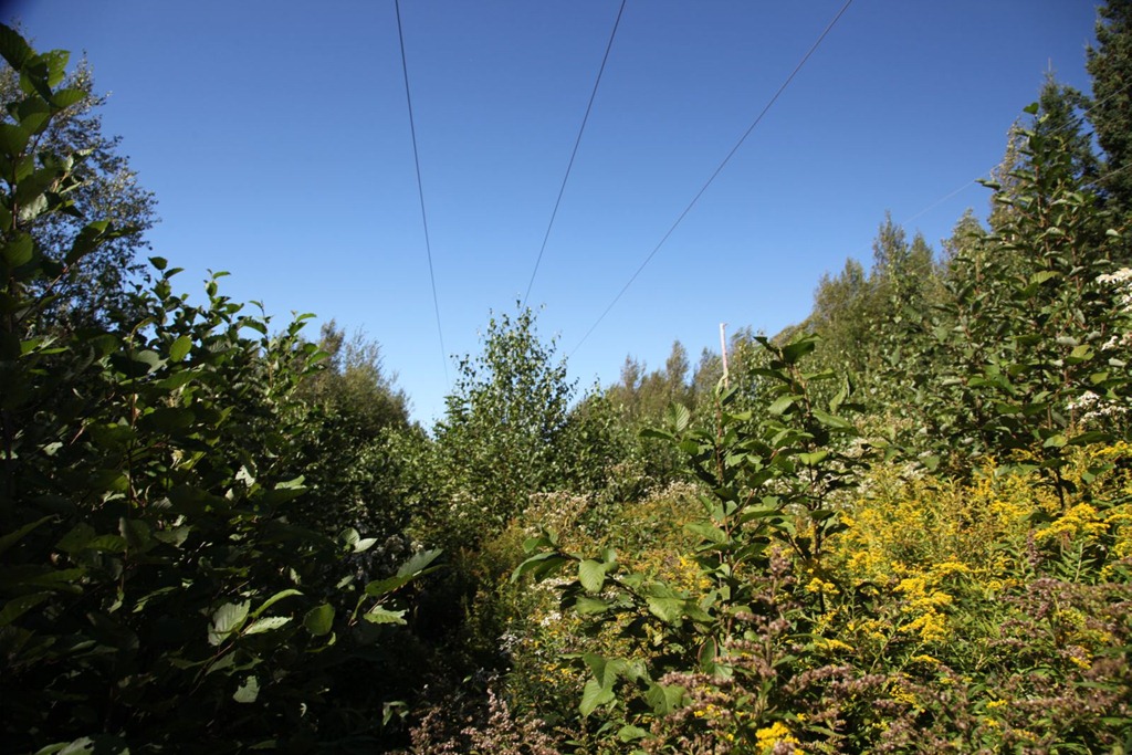
Young trees at just the right height to be a nuisance, and lots of tall plants. I slogged through this for perhaps 1/8 of a mile, but saw no sign of anything familiar. The going wasn’t getting any easier, and I was afraid of running into wild animals since there was nobody else around for at least half a mile. Perhaps I didn’t go far enough, but I doubt I would have spotted anything anyway. There was no sign of my uncle’s house either, and it should have been much more obvious.
My main memory from this place concerns the woods on the side opposite our house:

These woods are the only place I can remember ever getting lost. Once when I was three or four, I wandered in there and before long I realized I was disoriented and didn’t know which way led back to home. It was a little frightening since there’s nothing but more woods in most directions. This is the first case when I can remember deliberately employing knowledge and reasoning to solve a problem – I remembered roughly the direction of the sun when I went into the woods, and combining that with the certainty of which sides of the laneway and stream I was on, I was confident of which way I had to go to reach the laneway. And it worked. All told I was in there for perhaps an hour – definitely less than two – but it was scary and I resolved never to get lost again. And I haven’t. After that I put effort into developing my navigation and cartographic skills, and I maintain them to this day.
On the way to Harcourt, I passed a site I didn’t know existed: an internment camp. The base of the water tower is the only structure that remains now:

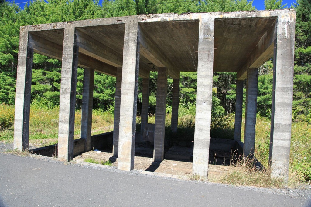
The sign says that Winston Churchill asked Canada to stow some Jewish refugees from Austria and Poland here for a while during WWII. After that, POWs were housed here – German and Italian merchant marines, and Canadian sympathizers including the Mayor of Montreal.
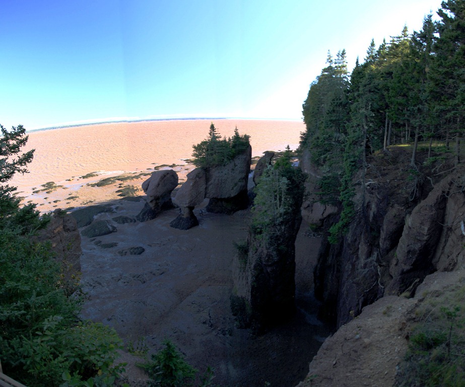
After getting my hotel room in Moncton, I headed further south to check out the Hopewell Rocks. Unfortunately the park was just closing as I got there, and I wasn’t allowed to go down and walk among the rocks. I did get some pictures from above, though the light was poor:
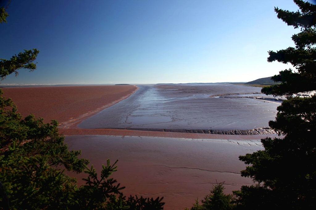
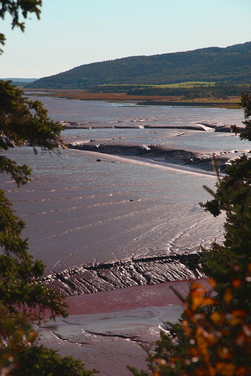
Further along the shore there is a huge mud beach. My photos don’t quite capture it, but all of this mud in today’s light looked just like melting chocolate – and it all comes from the equally brown Chocolate River, which looks like chocolate milk. Mmmm… chocolate…
I could sure use a Dairy Milk bar right now…
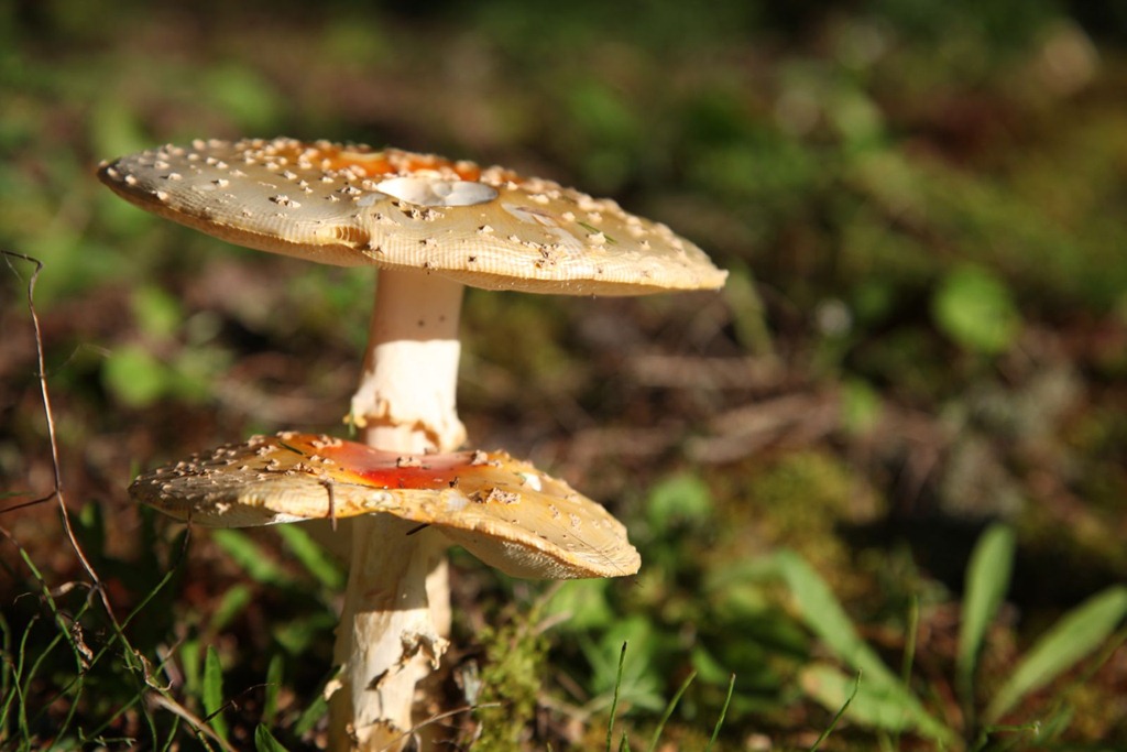
Also, Foadstools!
Overall today was a letdown – I couldn’t quite find the old house, I missed the best part of the Hopewell visit, and I made a disappointing decision that I’ll blog about separately. Trying not to let it all get me down too much.
[gmap file=”__UPLOAD__/2011/09/20110911.kml” zoom=”auto” center=”files” type=”satellite” visible=”true”]